Dardanelles,satellite image
Bildnummer 11746457
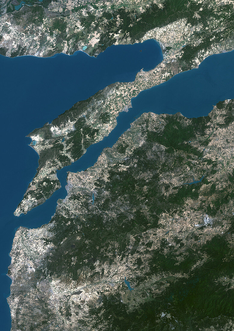
| Dardanelles. Satellite image of the Dardanelles (centre) in northwestern Turkey,a 61 kilometre long strait that separates European Turkey (top) from Asiatic Turkey (bottom). North is at top. The maximum width is 7 kilometres and in the area known as the Narrows,the distance is no more than 1,600 metres. It is a vital transportation route between the Black sea and the Mediterranean Sea,connecting the Aegean Sea (left) to the Sea of Marmara (where the strait opens up at far right) | |
| Lizenzart: | Lizenzpflichtig |
| Credit: | Science Photo Library / Planetobserver |
| Bildgröße: | 2492 px × 3525 px |
| Modell-Rechte: | nicht erforderlich |
| Eigentums-Rechte: | nicht erforderlich |
| Restrictions: | - |
Preise für dieses Bild ab 15 €
Universitäten & Organisationen
(Informationsmaterial Digital, Informationsmaterial Print, Lehrmaterial Digital etc.)
ab 15 €
Redaktionell
(Bücher, Bücher: Sach- und Fachliteratur, Digitale Medien (redaktionell) etc.)
ab 30 €
Werbung
(Anzeigen, Aussenwerbung, Digitale Medien, Fernsehwerbung, Karten, Werbemittel, Zeitschriften etc.)
ab 55 €
Handelsprodukte
(bedruckte Textilie, Kalender, Postkarte, Grußkarte, Verpackung etc.)
ab 75 €
Pauschalpreise
Rechtepakete für die unbeschränkte Bildnutzung in Print oder Online
ab 495 €