Saint Pierre and Miquelon,radar image
Bildnummer 11746340
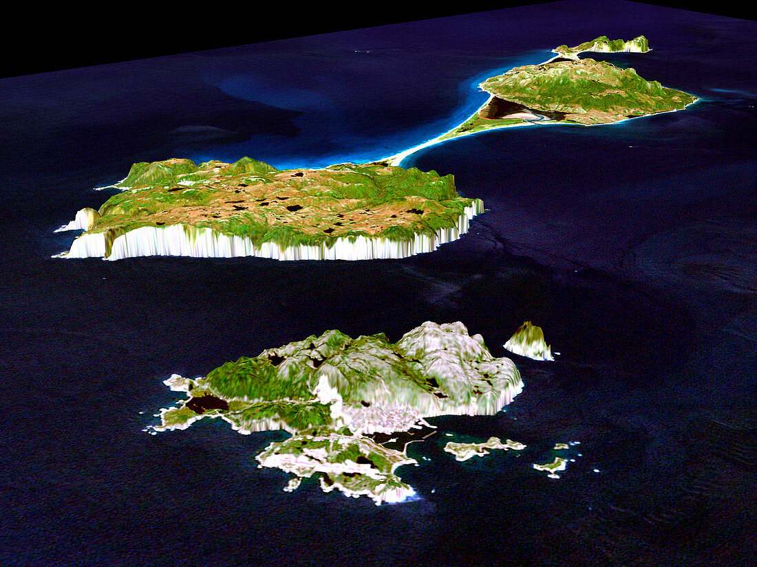
| Miquelon and Saint Pierre Islands. Coloured three- dimensional computer map of the French island territory of Saint Pierre (lower frame) and Miquelon,off Newfoundland,Canada. The land topography was mapped by the Shuttle Radar Topography Mission (SRTM) on the Space Shuttle Endeavour,using reflected radar pulses. Colours are from the Landsat 7 satellite. Grande Miquelon (top right) is linked to Petite Miquelon by a causeway. The coastal city of Saint Pierre (grey,lower centre) is protected from the Atlantic Ocean by a narrow breakwater. SRTM is run by NASA,the USA's National Imagery and Mapping Agency (NIMA),and the German and Italian space agencies | |
| Lizenzart: | Lizenzpflichtig |
| Credit: | Science Photo Library / NASA |
| Bildgröße: | 4000 px × 3000 px |
| Modell-Rechte: | nicht erforderlich |
| Eigentums-Rechte: | nicht erforderlich |
| Restrictions: | - |
Preise für dieses Bild ab 15 €
Universitäten & Organisationen
(Informationsmaterial Digital, Informationsmaterial Print, Lehrmaterial Digital etc.)
ab 15 €
Redaktionell
(Bücher, Bücher: Sach- und Fachliteratur, Digitale Medien (redaktionell) etc.)
ab 30 €
Werbung
(Anzeigen, Aussenwerbung, Digitale Medien, Fernsehwerbung, Karten, Werbemittel, Zeitschriften etc.)
ab 55 €
Handelsprodukte
(bedruckte Textilie, Kalender, Postkarte, Grußkarte, Verpackung etc.)
ab 75 €
Pauschalpreise
Rechtepakete für die unbeschränkte Bildnutzung in Print oder Online
ab 495 €
Keywords
- 3-d,
- abgebildet,
- Amerikanisch,
- Atlantisch,
- Deutsche,
- Dorf,
- Dreidimensional,
- farbig,
- Frankreich,
- Französisch,
- geografisch,
- Geographie,
- Geologie,
- geologisch,
- Hauptstadt,
- Insel,
- Inseln,
- Italienisch,
- Kanada,
- Kanadisch,
- Karte,
- Karten,
- Land,
- Meer,
- Mission,
- NASA,
- Oberfläche,
- Ozean,
- Saint Pierre,
- Satellit,
- SRTM,
- Stadt,
- städtisch,
- Terrain,
- topografisch,
- Umwelt,
- uns,
- Wasser,
- Wellenbrecher,
- Weltall