Mato Grosso State,Brazil
Bildnummer 11746054
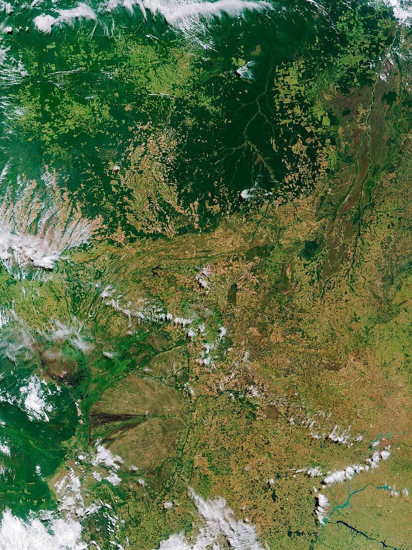
| Mato Grosso State. Satellite image of part of the west-central state of Mato Grosso,Brazil. Its name means the Great Woods. North is at top. Dense forest is dark green. The whole state occupies an area of over one million square kilometres. It has been associated with the search for lost tribes and civilisations,but despite many expeditions none have been found. The forest is still relatively undeveloped,but some settlements and farms are seen (geometric shapes). Photographed on 22 May 2001 by the Moderate Resolution Imaging Spectroradiometer (MODIS),on board NASA's Terra satellite | |
| Lizenzart: | Lizenzpflichtig |
| Credit: | Science Photo Library / NASA |
| Bildgröße: | 3375 px × 4500 px |
| Modell-Rechte: | nicht erforderlich |
| Eigentums-Rechte: | nicht erforderlich |
| Restrictions: | - |
Preise für dieses Bild ab 15 €
Universitäten & Organisationen
(Informationsmaterial Digital, Informationsmaterial Print, Lehrmaterial Digital etc.)
ab 15 €
Redaktionell
(Bücher, Bücher: Sach- und Fachliteratur, Digitale Medien (redaktionell) etc.)
ab 30 €
Werbung
(Anzeigen, Aussenwerbung, Digitale Medien, Fernsehwerbung, Karten, Werbemittel, Zeitschriften etc.)
ab 55 €
Handelsprodukte
(bedruckte Textilie, Kalender, Postkarte, Grußkarte, Verpackung etc.)
ab 75 €
Pauschalpreise
Rechtepakete für die unbeschränkte Bildnutzung in Print oder Online
ab 495 €