Syrian Desert,satellite image
Bildnummer 11745887
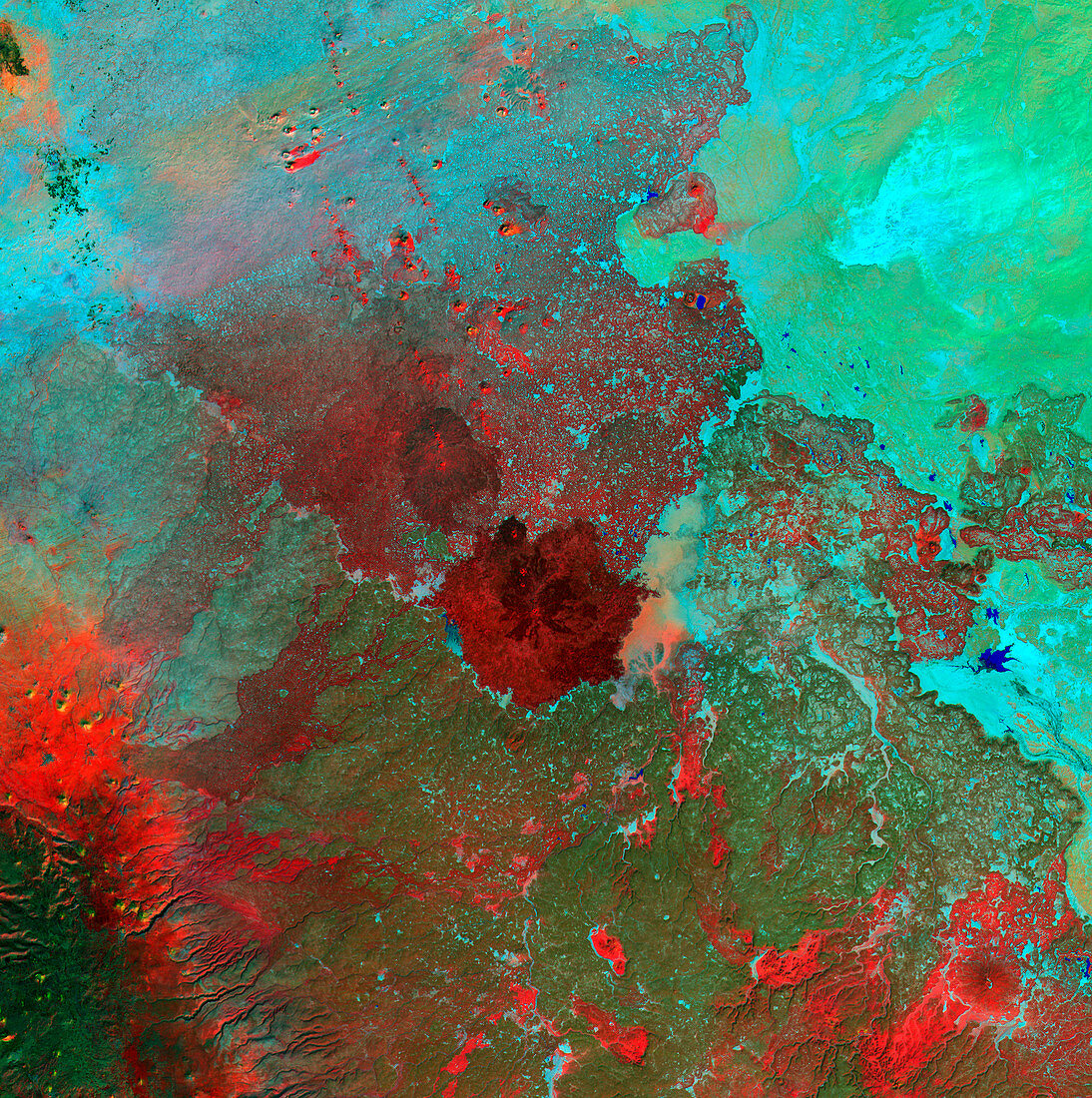
| Syrian Desert,satellite image. North is at top. Vegetation is red and dark green,while arid areas of sand and rock are light green and light blue. Water is blue. At centre is Jabal Sis,a huge extinct volcanic crater rising 100 metres above the surrounding plain. This area,part of the Syrian Desert,is in south-western Syria,near the border with Jordan. The water flow patterns on the landscape are evidence of seasonal flooding that supports the sparse vegetation in this area. The area shown in this image is around 100 kilometres wide. The image data includes infrared wavelengths,and was obtained on 6 November 2000,by the Landsat 7 satellite | |
| Lizenzart: | Lizenzpflichtig |
| Credit: | Science Photo Library / NASA |
| Bildgröße: | 4800 px × 4827 px |
| Modell-Rechte: | nicht erforderlich |
| Eigentums-Rechte: | nicht erforderlich |
| Restrictions: | - |
Preise für dieses Bild ab 15 €
Universitäten & Organisationen
(Informationsmaterial Digital, Informationsmaterial Print, Lehrmaterial Digital etc.)
ab 15 €
Redaktionell
(Bücher, Bücher: Sach- und Fachliteratur, Digitale Medien (redaktionell) etc.)
ab 30 €
Werbung
(Anzeigen, Aussenwerbung, Digitale Medien, Fernsehwerbung, Karten, Werbemittel, Zeitschriften etc.)
ab 55 €
Handelsprodukte
(bedruckte Textilie, Kalender, Postkarte, Grußkarte, Verpackung etc.)
ab 75 €
Pauschalpreise
Rechtepakete für die unbeschränkte Bildnutzung in Print oder Online
ab 495 €
Keywords
- 2000,
- 2000er Jahre,
- 21. Jahrhundert,
- Asiatisch,
- Asien,
- ausgestorben,
- Caldera,
- Erdbeobachtung,
- Felsig,
- geografisch,
- Geographie,
- infrarot,
- ir,
- Land,
- Landsat 7,
- Mittlerer Osten,
- Nahost,
- Natur,
- November,
- sandig,
- Satellit,
- Satellitenbild,
- Syrien,
- Syrisch,
- Umwelt,
- Vegetation,
- Vulkan,
- Vulkanologie,
- Weltall,
- Wüste