Desert oases,UAE
Bildnummer 11745824
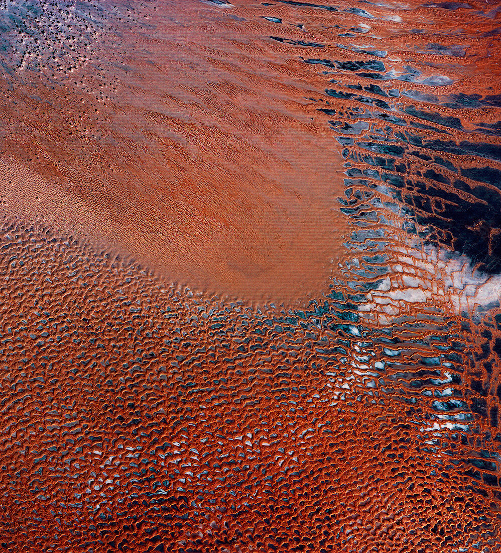
| Desert oases,United Arab Emirates (UAE),infrared satellite image. North is at top. This is one of the few habitable areas in the deserts (brown) of the UAE. Called Al-Liwa,the crescent-shaped area separates the sandy desert (upper left) from an area of gravel plains (dark blue,mostly upper right) surrounded by towering sand dunes (brown). Salty groundwater forms deposits (white),while a limited supply of fresh water supports agriculture in Al-Liwa. This 180-kilometre-wide image was taken on 11 November 1972,in visible and infrared wavelengths with the Multispectral Scanner (MSS) sensor on NASA's Landsat 1 satellite | |
| Lizenzart: | Lizenzpflichtig |
| Credit: | Science Photo Library / MDA Information Systems |
| Bildgröße: | 3987 px × 4394 px |
| Modell-Rechte: | nicht erforderlich |
| Eigentums-Rechte: | nicht erforderlich |
| Restrictions: | - |
Preise für dieses Bild ab 15 €
Universitäten & Organisationen
(Informationsmaterial Digital, Informationsmaterial Print, Lehrmaterial Digital etc.)
ab 15 €
Redaktionell
(Bücher, Bücher: Sach- und Fachliteratur, Digitale Medien (redaktionell) etc.)
ab 30 €
Werbung
(Anzeigen, Aussenwerbung, Digitale Medien, Fernsehwerbung, Karten, Werbemittel, Zeitschriften etc.)
ab 55 €
Handelsprodukte
(bedruckte Textilie, Kalender, Postkarte, Grußkarte, Verpackung etc.)
ab 75 €
Pauschalpreise
Rechtepakete für die unbeschränkte Bildnutzung in Print oder Online
ab 495 €