Atacama Desert & Andean foothils,N.Chile
Bildnummer 11745779
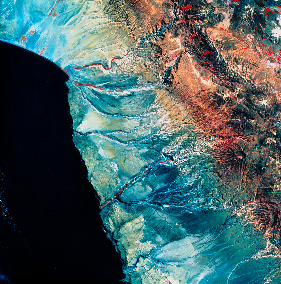
| Atacama Desert. Coloured satellite view of part of the Atacama desert,northern Chile. The desert is one of the driest places on Earth. The only signs of vegetation are occasional red patches in seasonal river valleys. In the top left of the frame are vast alluvial fans,indicating a history of seasonal flooding by water running off the nearby Andes Mountains (brown colours). The geography here is typical of a destructive (or convergent) plate margin,with a range of volcanic mountains and a narrow coastal plain. The data for this image were gathered by a Landsat satellite | |
| Lizenzart: | Lizenzpflichtig |
| Credit: | Science Photo Library / MDA Information Systems |
| Bildgröße: | 4252 px × 4296 px |
| Modell-Rechte: | nicht erforderlich |
| Eigentums-Rechte: | nicht erforderlich |
| Restrictions: | - |
Preise für dieses Bild ab 15 €
Universitäten & Organisationen
(Informationsmaterial Digital, Informationsmaterial Print, Lehrmaterial Digital etc.)
ab 15 €
Redaktionell
(Bücher, Bücher: Sach- und Fachliteratur, Digitale Medien (redaktionell) etc.)
ab 30 €
Werbung
(Anzeigen, Aussenwerbung, Digitale Medien, Fernsehwerbung, Karten, Werbemittel, Zeitschriften etc.)
ab 55 €
Handelsprodukte
(bedruckte Textilie, Kalender, Postkarte, Grußkarte, Verpackung etc.)
ab 75 €
Pauschalpreise
Rechtepakete für die unbeschränkte Bildnutzung in Print oder Online
ab 495 €