Landsat image of the desert showing sand dunes
Bildnummer 11745733
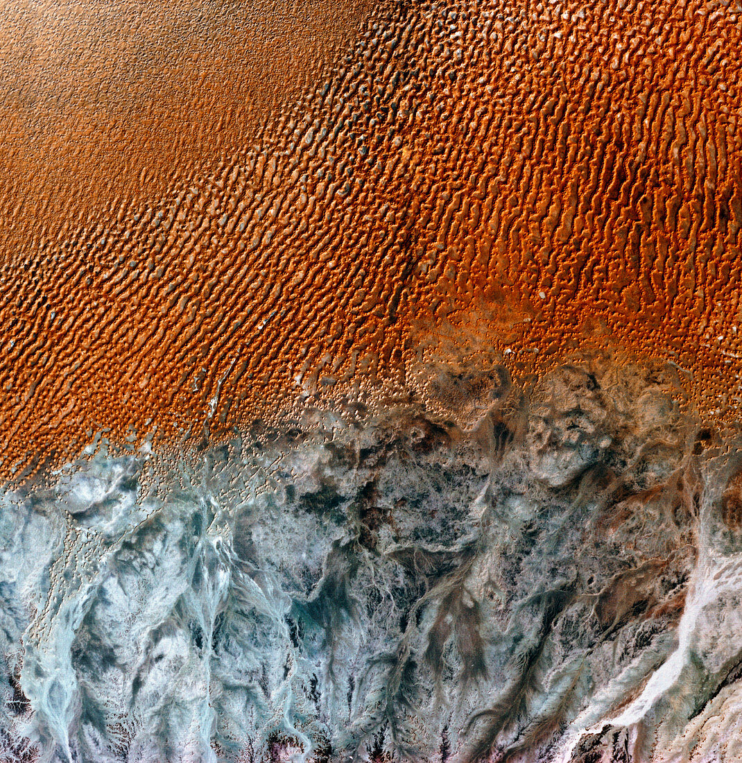
| Arabian desert. Infrared satellite image of the Arabian desert. North is at top. In the upper frame are sand dunes whilst barren rock appears grey in the lower frame. Dunes form in sandy areas where the prevailing wind usually blows from one direction. Image of Ramlat Mitan in western Oman,taken by the American Landsat satellite | |
| Lizenzart: | Lizenzpflichtig |
| Credit: | Science Photo Library / MDA Information Systems |
| Bildgröße: | 4225 px × 4342 px |
| Modell-Rechte: | nicht erforderlich |
| Eigentums-Rechte: | nicht erforderlich |
| Restrictions: | - |
Preise für dieses Bild ab 15 €
Universitäten & Organisationen
(Informationsmaterial Digital, Informationsmaterial Print, Lehrmaterial Digital etc.)
ab 15 €
Redaktionell
(Bücher, Bücher: Sach- und Fachliteratur, Digitale Medien (redaktionell) etc.)
ab 30 €
Werbung
(Anzeigen, Aussenwerbung, Digitale Medien, Fernsehwerbung, Karten, Werbemittel, Zeitschriften etc.)
ab 55 €
Handelsprodukte
(bedruckte Textilie, Kalender, Postkarte, Grußkarte, Verpackung etc.)
ab 75 €
Pauschalpreise
Rechtepakete für die unbeschränkte Bildnutzung in Print oder Online
ab 495 €
Keywords
- Arabien,
- Arabisch,
- Düne,
- Geographie,
- Oman,
- Sand,
- Umwelt,
- Weltall,
- Wüste,
- Wüstenlandschaft