River Nile
Bildnummer 11744888
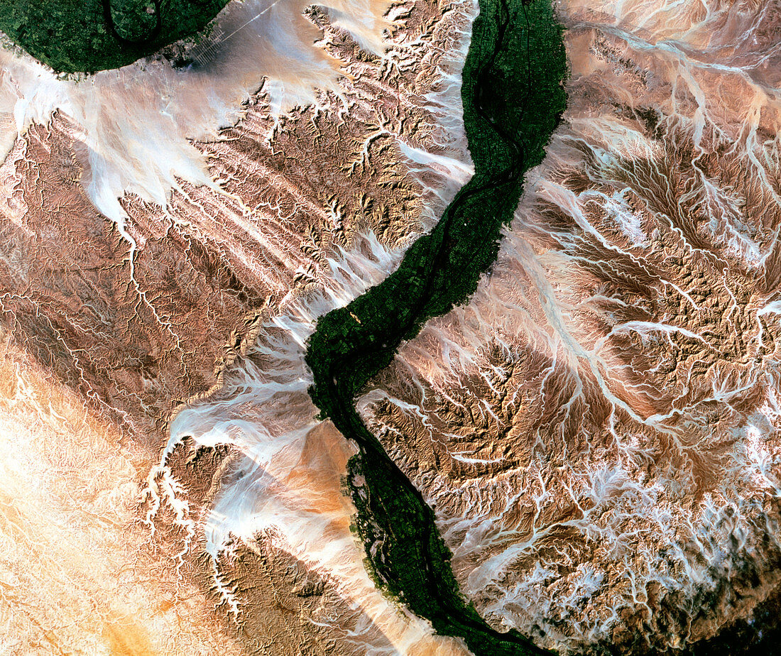
| River Nile,Luxor,Egypt,satellite image. North is at top. Water is black,vegetation is green and arid land is brown. The River Nile flows south to north through the mountains and deserts of Egypt. Its waters sustain agricultural fields (green) in this area of low rainfall. The image is centred on the city of Luxor,famous for its ruins dating to the time of Ancient Egypt. This 115-kilometre-wide image was taken on 22 January 1986,in visible and infrared wavelengths,with the Thematic Mapper (TM) sensor on a NASA Landsat satellite | |
| Lizenzart: | Lizenzpflichtig |
| Credit: | Science Photo Library / MDA Information Systems |
| Bildgröße: | 4090 px × 3437 px |
| Modell-Rechte: | nicht erforderlich |
| Eigentums-Rechte: | nicht erforderlich |
| Restrictions: | - |
Preise für dieses Bild ab 15 €
Universitäten & Organisationen
(Informationsmaterial Digital, Informationsmaterial Print, Lehrmaterial Digital etc.)
ab 15 €
Redaktionell
(Bücher, Bücher: Sach- und Fachliteratur, Digitale Medien (redaktionell) etc.)
ab 30 €
Werbung
(Anzeigen, Aussenwerbung, Digitale Medien, Fernsehwerbung, Karten, Werbemittel, Zeitschriften etc.)
ab 55 €
Handelsprodukte
(bedruckte Textilie, Kalender, Postkarte, Grußkarte, Verpackung etc.)
ab 75 €
Pauschalpreise
Rechtepakete für die unbeschränkte Bildnutzung in Print oder Online
ab 495 €
Keywords
- Afrika,
- Afrikanisch,
- Ägypten,
- Ägyptisch,
- Anbau,
- Bauernhof,
- Bauernhöfe,
- Berg,
- Berge,
- bewässert,
- Bewässerung,
- Bodennutzung,
- farbig,
- Feld,
- Felder,
- Fluss,
- geografisch,
- Geographie,
- infrarot,
- ir,
- Januar,
- kultiviert,
- Landwirtschaft,
- landwirtschaftlich,
- montan,
- Nil,
- optisch,
- Pflanzen,
- Satellit,
- Sichtbar,
- Stadt,
- Tm,
- trocken,
- Umwelt,
- Vegetation,
- Wasser,
- Weltall,
- Wüste