Tigil River,radar image
Bildnummer 11744882
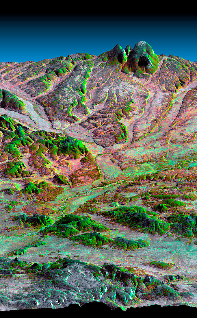
| Tigil River. Coloured three-dimensional computer map of the Tigil River (centre right to lower left) on the Kamchatka Peninsula,Russia. The image was produced by the Shuttle Radar Topography Mission (SRTM) on the Space Shuttle Endeavour,which uses reflected radar pulses to map the topography of the land below. The Tigil has eroded layers of volcanic debris deposited by nearby volcanoes,and now flows through bedrock (lower frame). The colours were provided by the Landsat 7 satellite. Vegetation is green and bare earth is brown. SRTM is run by NASA,the USA's National Imagery and Mapping Agency (NIMA),and the German and Italian space agencies | |
| Lizenzart: | Lizenzpflichtig |
| Credit: | Science Photo Library / NASA |
| Bildgröße: | 1363 px × 2200 px |
| Modell-Rechte: | nicht erforderlich |
| Eigentums-Rechte: | nicht erforderlich |
| Restrictions: | - |
Preise für dieses Bild ab 15 €
Universitäten & Organisationen
(Informationsmaterial Digital, Informationsmaterial Print, Lehrmaterial Digital etc.)
ab 15 €
Redaktionell
(Bücher, Bücher: Sach- und Fachliteratur, Digitale Medien (redaktionell) etc.)
ab 30 €
Werbung
(Anzeigen, Aussenwerbung, Digitale Medien, Fernsehwerbung, Karten, Werbemittel, Zeitschriften etc.)
ab 55 €
Handelsprodukte
(bedruckte Textilie, Kalender, Postkarte, Grußkarte, Verpackung etc.)
ab 75 €
Pauschalpreise
Rechtepakete für die unbeschränkte Bildnutzung in Print oder Online
ab 495 €
Keywords
- 3-d,
- abgebildet,
- Amerikanisch,
- Deutsche,
- Dreidimensional,
- erodiert,
- Erosion,
- farbig,
- Felsen,
- Felsig,
- geografisch,
- Geographie,
- Geologie,
- geologisch,
- Italienisch,
- Karte,
- Karten,
- Land,
- Landsat 7,
- Mission,
- NASA,
- Oberfläche,
- Russisch,
- Russland,
- Satellit,
- SRTM,
- Tal,
- Terrain,
- topografisch,
- uns,
- Vegetation,
- vulkanisch,
- Weltall