Sredinnyy Khrebet volcanoes,radar image
Bildnummer 11740679
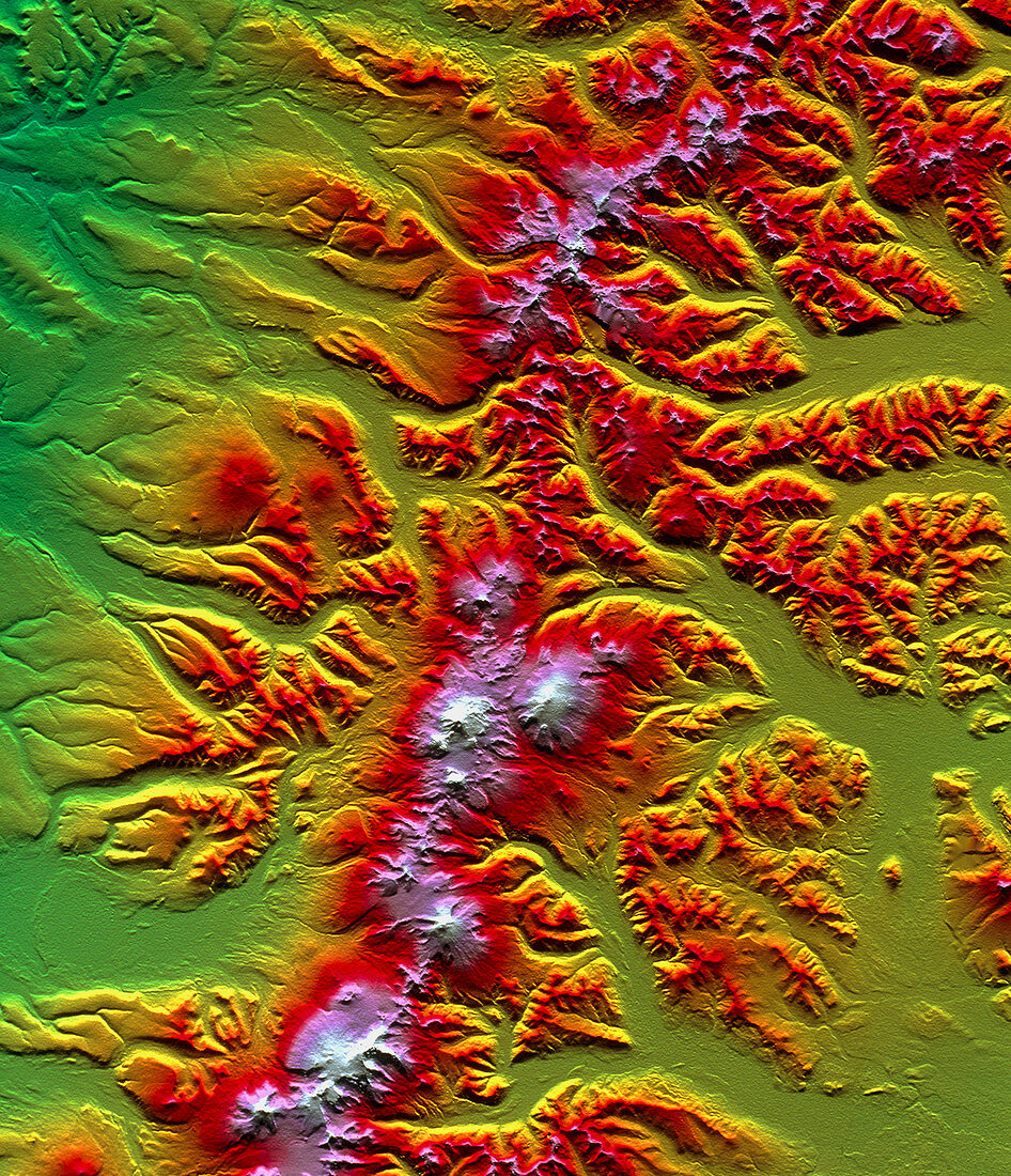
| Sredinnyy Khrebet volcanoes. Coloured three- dimensional computer map of the Sredinnyy Khrebet volcanoes in Kamchatka Peninsula,Russia. North is at top. The topography of the region was mapped by the Shuttle Radar Topography Mission (SRTM) on the Space Shuttle Endeavour,using reflected radar pulses. Colour-coding reveals elevation: green is lowest,rising through yellow,red and pink to white,the highest. The Sredinnyy Khrebet range dominates the region. Volcanic lava has smoothed the rugged terrain around the highest peaks (white,lower centre). SRTM is run by NASA,the USA's National Imagery and Mapping Agency (NIMA),and the German and Italian space agencies | |
| Lizenzart: | Lizenzpflichtig |
| Credit: | Science Photo Library / NASA |
| Bildgröße: | 3046 px × 3543 px |
| Modell-Rechte: | nicht erforderlich |
| Eigentums-Rechte: | nicht erforderlich |
| Restrictions: | - |
Preise für dieses Bild ab 15 €
Universitäten & Organisationen
(Informationsmaterial Digital, Informationsmaterial Print, Lehrmaterial Digital etc.)
ab 15 €
Redaktionell
(Bücher, Bücher: Sach- und Fachliteratur, Digitale Medien (redaktionell) etc.)
ab 30 €
Werbung
(Anzeigen, Aussenwerbung, Digitale Medien, Fernsehwerbung, Karten, Werbemittel, Zeitschriften etc.)
ab 55 €
Handelsprodukte
(bedruckte Textilie, Kalender, Postkarte, Grußkarte, Verpackung etc.)
ab 75 €
Pauschalpreise
Rechtepakete für die unbeschränkte Bildnutzung in Print oder Online
ab 495 €
Keywords
- 3-d,
- abgebildet,
- aktiv,
- Amerikanisch,
- Berg,
- Berge,
- Deutsche,
- Dreidimensional,
- Fließen,
- geografisch,
- Geographie,
- Geologie,
- geologisch,
- Italienisch,
- Karte,
- Karten,
- Land,
- Lava,
- Mission,
- NASA,
- Oberfläche,
- Reichweite,
- Russisch,
- Russland,
- SRTM,
- Terrain,
- topografisch,
- uns,
- Vertikal,
- Vulkan,
- Vulkane,
- vulkanisch,
- Weltall