Bathymetry and topography of the Arctic
Bildnummer 11740209
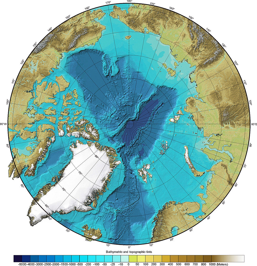
| Bathymetry and topography of the Arctic. This image is centred on the North Pole and shows the varying depths of the Arctic Ocean (with increasing depths going from turquoise to navy blue). The height of the land around the ocean varies,increasing from green through brown to white. This topographic map was constructed using a geographic information system (GIS) that captured,stored and analysed the Arctic region's topographic and bathymetric data. Topographic and bathymetric data is usually gathered by using aerial and satellite imagery combined with radar and sonar mapping. This project is the International Bathymetric Chart of the Arctic Ocean (IBCAO) and commenced in 1997 | |
| Lizenzart: | Lizenzpflichtig |
| Credit: | Science Photo Library / NOAA |
| Bildgröße: | 2902 px × 3011 px |
| Modell-Rechte: | nicht erforderlich |
| Eigentums-Rechte: | nicht erforderlich |
| Restrictions: |
|
Preise für dieses Bild ab 15 €
Universitäten & Organisationen
(Informationsmaterial Digital, Informationsmaterial Print, Lehrmaterial Digital etc.)
ab 15 €
Redaktionell
(Bücher, Bücher: Sach- und Fachliteratur, Digitale Medien (redaktionell) etc.)
ab 30 €
Werbung
(Anzeigen, Aussenwerbung, Digitale Medien, Fernsehwerbung, Karten, Werbemittel, Zeitschriften etc.)
ab 55 €
Handelsprodukte
(bedruckte Textilie, Kalender, Postkarte, Grußkarte, Verpackung etc.)
ab 75 €
Pauschalpreise
Rechtepakete für die unbeschränkte Bildnutzung in Print oder Online
ab 495 €
Keywords
- Arktis,
- Arktischer Ozean,
- Bathymetrie,
- bathymetrisch,
- Diagramm,
- Erdbeobachtung,
- Erde,
- geografisch,
- Geographie,
- Globus,
- Karte,
- Kontinent,
- Kreis,
- kreisförmig,
- Küste,
- Küsten-,
- Land,
- Meer,
- Meeresboden,
- Meereskunde,
- nördliche Hemisphäre,
- Nördlicher Polarkreis,
- Nordpol,
- Ozean,
- polar,
- Polarregion,
- rund,
- Satellit,
- Satellitenbild,
- Tief,
- topografisch,
- Topographie,
- topographisch,
- Weltall,
- weltweit