Tsunami computer simulation
Bildnummer 11739836
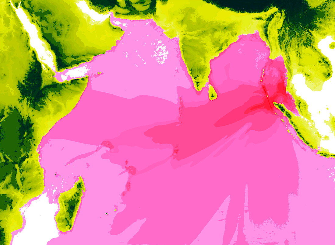
| Tsunami 2004. Computer simulation of wave height during the Asian tsunami. On 26 December 2004 an underwater earthquake along northern Sumatra (far right) caused a massive movement of water throughout the Indian Ocean. The maximum height of the tsunami waves from 0 metres (white) to 5 metres (dark pink) is shown in this computer simulation over 15 hours after the earthquake. The tsunami was the most devastating in recorded history,with over 200,000 people killed. Coastlines affected by the tsunami include: East Africa (left),Thailand (upper right),India (top centre) and Sri Lanka (below India) | |
| Lizenzart: | Lizenzpflichtig |
| Credit: | Science Photo Library / YALCINER, KURAN, TAYMAZ |
| Bildgröße: | 3595 px × 2635 px |
| Modell-Rechte: | nicht erforderlich |
| Eigentums-Rechte: | nicht erforderlich |
| Restrictions: | - |
Preise für dieses Bild ab 15 €
Universitäten & Organisationen
(Informationsmaterial Digital, Informationsmaterial Print, Lehrmaterial Digital etc.)
ab 15 €
Redaktionell
(Bücher, Bücher: Sach- und Fachliteratur, Digitale Medien (redaktionell) etc.)
ab 30 €
Werbung
(Anzeigen, Aussenwerbung, Digitale Medien, Fernsehwerbung, Karten, Werbemittel, Zeitschriften etc.)
ab 55 €
Handelsprodukte
(bedruckte Textilie, Kalender, Postkarte, Grußkarte, Verpackung etc.)
ab 75 €
Pauschalpreise
Rechtepakete für die unbeschränkte Bildnutzung in Print oder Online
ab 495 €