Indonesian coastline,before 2004 tsunami
Bildnummer 11739824
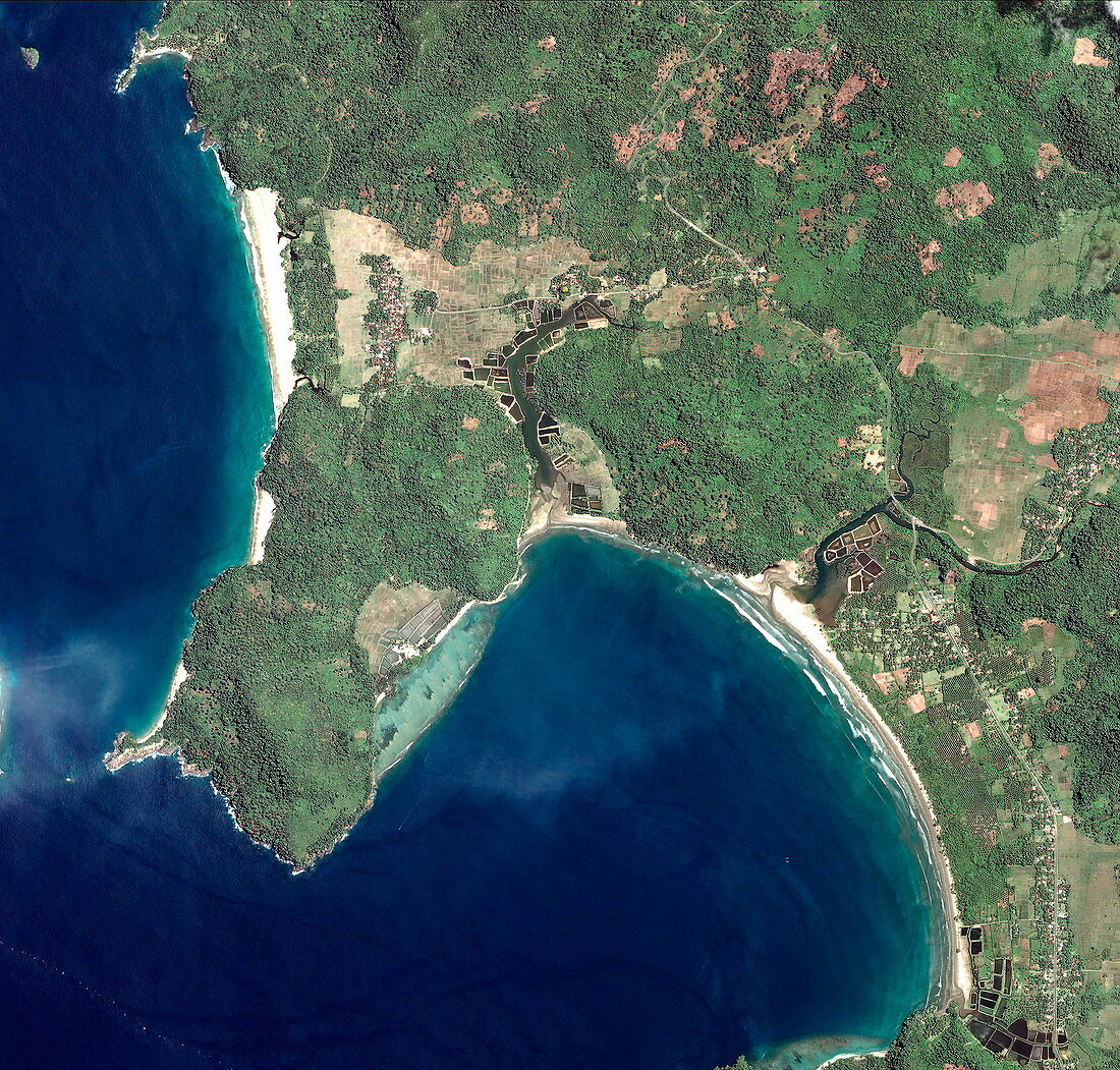
| Before tsunami. Image 1 of 2. Satellite image of the Indonesian coastline,near Gleebruk,on 12 April 2004. The hillsides are heavily forested and there are fields and villages in the lowlands by rivers and coastal roads,and two beaches. On the morning of 26 December 2004,a massive underwater earthquake,some 160 kilometres west of this area,created huge waves,or tsunamis,that devastated areas around the Indian Ocean. The lowland areas here were completely wiped out. Over 100,000 died in Indonesia,and many more elsewhere. The full death toll may never be known. Quickbird satellite image. For the post-tsunami image,see E275/037 | |
| Lizenzart: | Lizenzpflichtig |
| Credit: | Science Photo Library / Digital Globe, Eurimage |
| Bildgröße: | 2562 px × 2449 px |
| Modell-Rechte: | nicht erforderlich |
| Eigentums-Rechte: | nicht erforderlich |
| Restrictions: |
|
Preise für dieses Bild ab 15 €
Universitäten & Organisationen
(Informationsmaterial Digital, Informationsmaterial Print, Lehrmaterial Digital etc.)
ab 15 €
Redaktionell
(Bücher, Bücher: Sach- und Fachliteratur, Digitale Medien (redaktionell) etc.)
ab 30 €
Werbung
(Anzeigen, Aussenwerbung, Digitale Medien, Fernsehwerbung, Karten, Werbemittel, Zeitschriften etc.)
ab 55 €
Handelsprodukte
(bedruckte Textilie, Kalender, Postkarte, Grußkarte, Verpackung etc.)
ab 75 €
Pauschalpreise
Rechtepakete für die unbeschränkte Bildnutzung in Print oder Online
ab 495 €
Keywords
- April,
- Asiatisch,
- Asien,
- Bauernhof,
- Bauernhöfe,
- Bäume,
- bewaldet,
- Dezember,
- Dorf,
- Dörfer,
- Erdbeben,
- Erdbeobachtung,
- Feld,
- Felder,
- Flutwelle,
- Gleebruk,
- Indischer Ozean,
- Indonesien,
- Indonesisch,
- Katastrophe,
- Küste,
- Küsten-,
- Küstenlinie,
- ländlich,
- Landschaft,
- natürlich,
- Reihenfolge,
- Satellit,
- Satellitenbild,
- Schaden,
- seismische Aktivität,
- Seismologie,
- Strand,
- Strände,
- Straße,
- Südostasien,
- Sumatra,
- Tsunami,
- Ufer,
- vorher,
- Wald,
- Weltall