Indonesian coastline after 2004 tsunami
Bildnummer 11739805
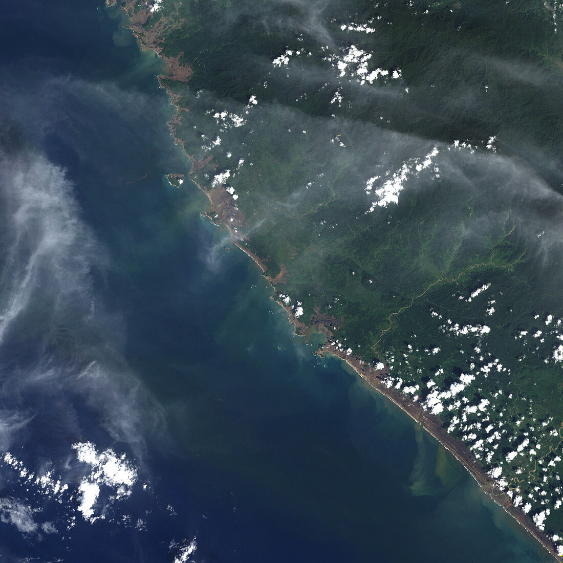
| Tsunami. Image 2 of 2. Coastline of Aceh province,Sumatra,Indonesia,after the tsunami of 26 December 2004. This Landsat image was taken on 29 December 2004. On 26 December an earthquake measuring 9.0 on the Richter Scale,the largest for 40 years,occurred underwater between the Eurasian and Australian plates off the coast of Indonesia. Shockwaves from this created huge waves,or tsunamis,which have killed over 150,000 and caused massive devastation in the surrounding countries. A strip of deforestation 1.5 kilometres-thick can be seen along the coastline. For an image of the coast after the tsunami,see record E275/014 | |
| Lizenzart: | Lizenzpflichtig |
| Credit: | Science Photo Library / NASA |
| Bildgröße: | 2864 px × 2864 px |
| Modell-Rechte: | nicht erforderlich |
| Eigentums-Rechte: | nicht erforderlich |
| Restrictions: | - |
Preise für dieses Bild ab 15 €
Universitäten & Organisationen
(Informationsmaterial Digital, Informationsmaterial Print, Lehrmaterial Digital etc.)
ab 15 €
Redaktionell
(Bücher, Bücher: Sach- und Fachliteratur, Digitale Medien (redaktionell) etc.)
ab 30 €
Werbung
(Anzeigen, Aussenwerbung, Digitale Medien, Fernsehwerbung, Karten, Werbemittel, Zeitschriften etc.)
ab 55 €
Handelsprodukte
(bedruckte Textilie, Kalender, Postkarte, Grußkarte, Verpackung etc.)
ab 75 €
Pauschalpreise
Rechtepakete für die unbeschränkte Bildnutzung in Print oder Online
ab 495 €