Colour satellite image of coastal water (N.Africa)
Bildnummer 11739598
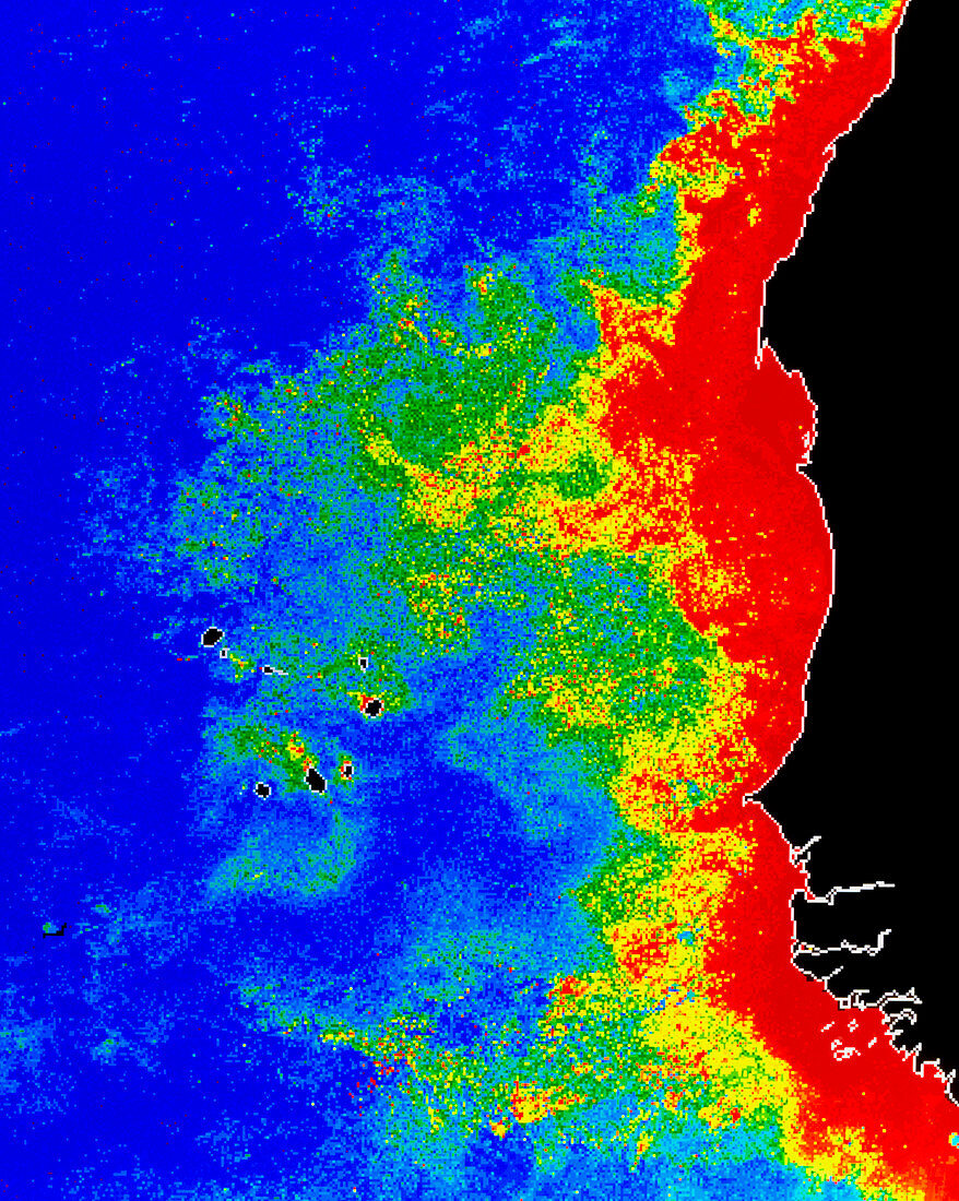
| False-colour satellite image of the coastal waters of northwest Africa,showing the distribution of phytoplankton in the surface waters. The colours represent varying phytoplankton densities from red (most dense) through orange,yellow and green to blue (least dense). The wind-driven upwelling of cool,nutrient-rich subsurface waters in this area causes the high phytoplankton concentrations which support some of the world's largest fisheries. The image was produced from data acquired by the Coastal Zone Colour Scanner,a radiometer with visible and infrared spectral channels which formed part of NASA's Nimbus-7 research satellite | |
| Lizenzart: | Lizenzpflichtig |
| Credit: | Science Photo Library / DR GENE FELDMAN, NASA GSFC |
| Bildgröße: | 3743 px × 4689 px |
| Modell-Rechte: | nicht erforderlich |
| Eigentums-Rechte: | nicht erforderlich |
| Restrictions: | - |
Preise für dieses Bild ab 15 €
Universitäten & Organisationen
(Informationsmaterial Digital, Informationsmaterial Print, Lehrmaterial Digital etc.)
ab 15 €
Redaktionell
(Bücher, Bücher: Sach- und Fachliteratur, Digitale Medien (redaktionell) etc.)
ab 30 €
Werbung
(Anzeigen, Aussenwerbung, Digitale Medien, Fernsehwerbung, Karten, Werbemittel, Zeitschriften etc.)
ab 55 €
Handelsprodukte
(bedruckte Textilie, Kalender, Postkarte, Grußkarte, Verpackung etc.)
ab 75 €
Pauschalpreise
Rechtepakete für die unbeschränkte Bildnutzung in Print oder Online
ab 495 €