Hurricane Rita,infrared image
Bildnummer 11738057
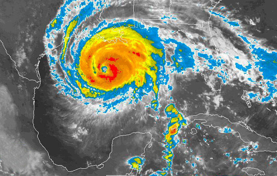
| Hurricane Rita. GOES infrared satellite image of Hurricane Rita over the Gulf of Mexico at 09:15 UTC on 23rd September 2005. North is at top. Lines show the geography of the land. Colours show the cloud temperature. The central,compact clouds are red/orange. At this point,Rita had weakened to a Category 4 hurricane,but was still expected to cause devastation as it moved north-west and made landfall near Houston,Texas,USA (upper left). Rita is the ninth hurricane of the 2005 Atlantic hurricane season,and among the most intense ever. Cuba (lower right) and part of Mexico (lower left) are also seen | |
| Lizenzart: | Lizenzpflichtig |
| Credit: | Science Photo Library / NOAA |
| Bildgröße: | 719 px × 456 px |
| Modell-Rechte: | nicht erforderlich |
| Eigentums-Rechte: | nicht erforderlich |
| Restrictions: |
|
Preise für dieses Bild ab 15 €
Universitäten & Organisationen
(Informationsmaterial Digital, Informationsmaterial Print, Lehrmaterial Digital etc.)
ab 15 €
Redaktionell
(Bücher, Bücher: Sach- und Fachliteratur, Digitale Medien (redaktionell) etc.)
ab 30 €
Werbung
(Anzeigen, Aussenwerbung, Digitale Medien, Fernsehwerbung, Karten, Werbemittel, Zeitschriften etc.)
ab 55 €
Handelsprodukte
(bedruckte Textilie, Kalender, Postkarte, Grußkarte, Verpackung etc.)
ab 75 €
Pauschalpreise
Rechtepakete für die unbeschränkte Bildnutzung in Print oder Online
ab 495 €