Hurricane Rita,sea temperatures
Bildnummer 11738054
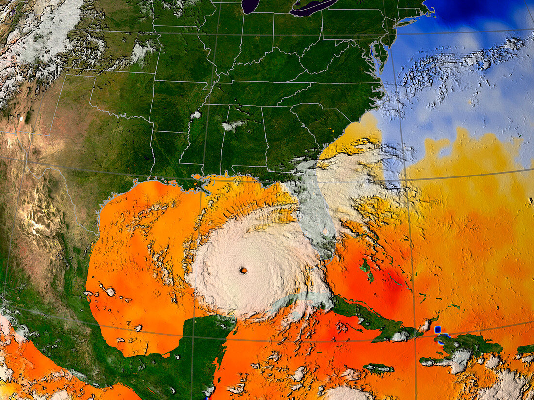
| Hurricane Rita. Sea temperature data acquired by satellite,and a GOES satellite image of Hurricane Rita at Category 5 strength,in the Gulf of Mexico at 20:15 UTC on 21st September 2005. North is at top. The red/orange colour shows areas where sea surface temperature is over 28 degrees Celsius,a few degrees warmer than the temperatures needed to form and fuel a hurricane. This may explain the record numbers and intensity of hurricanes in the 2005 Atlantic hurricane season. Rita is the ninth hurricane of the 2005 Atlantic hurricane season,and among the most intense ever. It formed only a few weeks after Hurricane Katrina devastated the Louisiana and Mississippi coastline | |
| Lizenzart: | Lizenzpflichtig |
| Credit: | Science Photo Library / NASA |
| Bildgröße: | 2560 px × 1920 px |
| Modell-Rechte: | nicht erforderlich |
| Eigentums-Rechte: | nicht erforderlich |
| Restrictions: | - |
Preise für dieses Bild ab 15 €
Universitäten & Organisationen
(Informationsmaterial Digital, Informationsmaterial Print, Lehrmaterial Digital etc.)
ab 15 €
Redaktionell
(Bücher, Bücher: Sach- und Fachliteratur, Digitale Medien (redaktionell) etc.)
ab 30 €
Werbung
(Anzeigen, Aussenwerbung, Digitale Medien, Fernsehwerbung, Karten, Werbemittel, Zeitschriften etc.)
ab 55 €
Handelsprodukte
(bedruckte Textilie, Kalender, Postkarte, Grußkarte, Verpackung etc.)
ab 75 €
Pauschalpreise
Rechtepakete für die unbeschränkte Bildnutzung in Print oder Online
ab 495 €