Hurricane Rita forming
Bildnummer 11738051
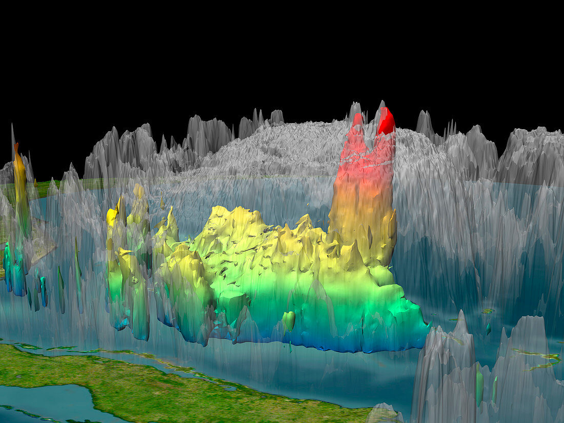
| Hurricane Rita forming. Rainfall data from the TRRM satellite on 19th September 2005,showing the formation of Hurricane Rita. This image is of the centre of the forming hurricane passing to the north of Cuba (lower left). Acklins Island is at lower right,and Florida,on the US mainland,is at centre left. The colour-coding reveals the height of the rainfall,with the red area showing rain and clouds towering 17 kilometres above the sea. This 'tower' formation can indicate that the storm will become more intense,and Tropical Storm Rita was declared a hurricane the next day. From here,it moved west into the Gulf of Mexico,and reached Category Five strength on 21st September 2005,as it moved towards Houston,Texas,USA | |
| Lizenzart: | Lizenzpflichtig |
| Credit: | Science Photo Library / NASA |
| Bildgröße: | 2560 px × 1920 px |
| Modell-Rechte: | nicht erforderlich |
| Eigentums-Rechte: | nicht erforderlich |
| Restrictions: | - |
Preise für dieses Bild ab 15 €
Universitäten & Organisationen
(Informationsmaterial Digital, Informationsmaterial Print, Lehrmaterial Digital etc.)
ab 15 €
Redaktionell
(Bücher, Bücher: Sach- und Fachliteratur, Digitale Medien (redaktionell) etc.)
ab 30 €
Werbung
(Anzeigen, Aussenwerbung, Digitale Medien, Fernsehwerbung, Karten, Werbemittel, Zeitschriften etc.)
ab 55 €
Handelsprodukte
(bedruckte Textilie, Kalender, Postkarte, Grußkarte, Verpackung etc.)
ab 75 €
Pauschalpreise
Rechtepakete für die unbeschränkte Bildnutzung in Print oder Online
ab 495 €