Hurricane Frances
Bildnummer 11738002
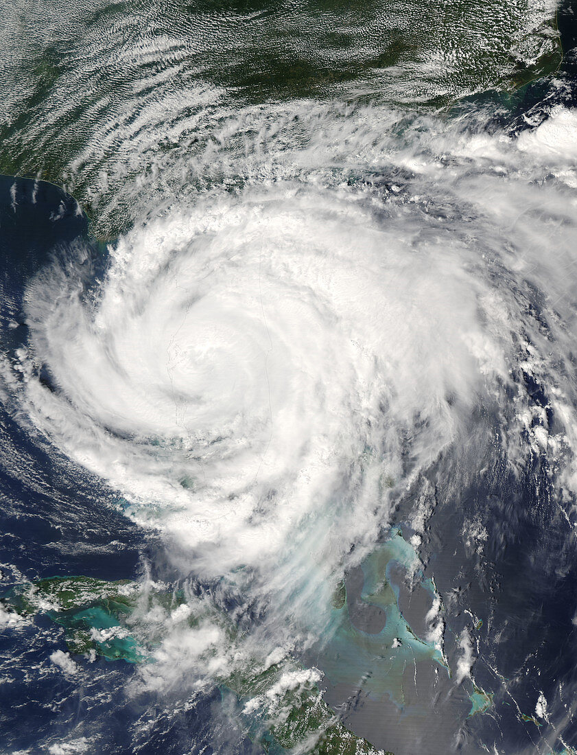
| Hurricane Frances. Satellite image of Hurricane Frances over Florida,USA,at 18:15 GMT on 4 September 2004. Cuba is at bottom left. Hurricane Frances passed over the islands of the Bahamas a few days earlier,reaching the US state of Florida from 3-5 September 2004. By this time it had grown in size to cover the southern half of the state. Although the winds had dropped in speed,it still caused immense damage and flooding,with over 2 million people evacuating their homes. Hurricanes are enormous rotating storm systems that form over tropical seas. They can be hundreds of kilometres wide. Image acquired by the Aqua satellite | |
| Lizenzart: | Lizenzpflichtig |
| Credit: | Science Photo Library / NASA |
| Bildgröße: | 5200 px × 6800 px |
| Modell-Rechte: | nicht erforderlich |
| Eigentums-Rechte: | nicht erforderlich |
| Restrictions: | - |
Preise für dieses Bild ab 15 €
Universitäten & Organisationen
(Informationsmaterial Digital, Informationsmaterial Print, Lehrmaterial Digital etc.)
ab 15 €
Redaktionell
(Bücher, Bücher: Sach- und Fachliteratur, Digitale Medien (redaktionell) etc.)
ab 30 €
Werbung
(Anzeigen, Aussenwerbung, Digitale Medien, Fernsehwerbung, Karten, Werbemittel, Zeitschriften etc.)
ab 55 €
Handelsprodukte
(bedruckte Textilie, Kalender, Postkarte, Grußkarte, Verpackung etc.)
ab 75 €
Pauschalpreise
Rechtepakete für die unbeschränkte Bildnutzung in Print oder Online
ab 495 €
Keywords
- 21. Jahrhundert,
- Amerikanisch,
- aqua,
- Auge,
- einer,
- Erdbeobachtung,
- extrem,
- Florida,
- Golf von Mexiko,
- Hurrikan,
- Karibik,
- Klimatologie,
- klimatologisch,
- Kuba,
- Küste,
- Land,
- Landung,
- Meer,
- Meteorologie,
- meteorologisch,
- modis,
- Naturkatastrophe,
- Ozean,
- Satellitenbild,
- Single,
- Spektroradiometer,
- Spiral,
- Spirale,
- spiralförmig,
- stark,
- Sturm,
- System,
- Tropisch,
- uns,
- USA,
- Vereinigte Staaten,
- Warnung,
- Weltall,
- Wetter,
- Wind,
- Windig,
- Wolke,
- Wolken