Satellite image of Hurricane Nora over the Pacific
Bildnummer 11737964
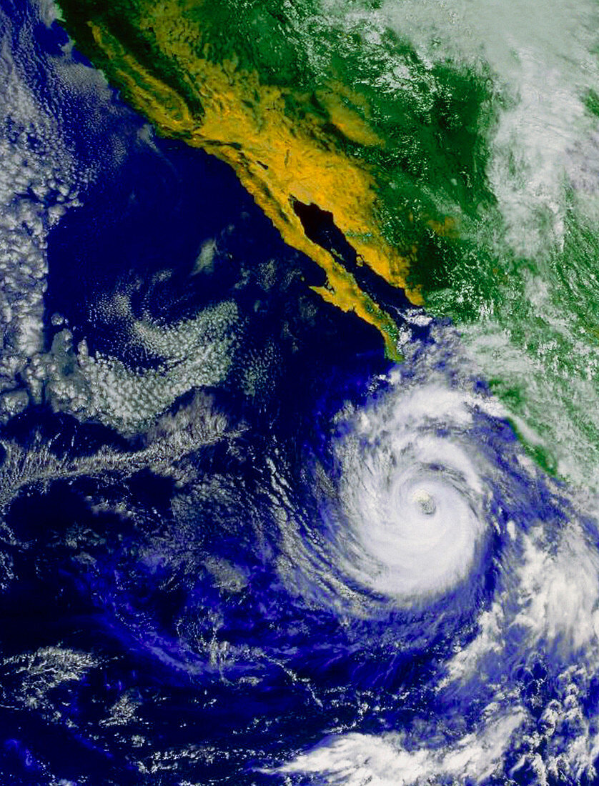
| Hurricane Nora. Satellite image of Hurricane Nora off the coast of Baja California,Mexico. The hurricane is the swirl of clouds surrounding the dark hole (the "eye") at lower right. The "eye" is comprised of relatively calm,cloud-free air at a very low pressure. Around this "eye" are very strong winds which blow at over 100 kilometres per hour. Hurricanes form in tropical regions and are caused by large-scale evaporation and convection due to warm sea temperatures. The eastward movement of warm water in the Pacific (known an El Nino event) may cause more hurricanes to form off the American continent's coast. Image taken on 22 September 1997 by the American GOES-9 satellite | |
| Lizenzart: | Lizenzpflichtig |
| Credit: | Science Photo Library / NASA |
| Bildgröße: | 2610 px × 3425 px |
| Modell-Rechte: | nicht erforderlich |
| Eigentums-Rechte: | nicht erforderlich |
| Restrictions: | - |
Preise für dieses Bild ab 15 €
Universitäten & Organisationen
(Informationsmaterial Digital, Informationsmaterial Print, Lehrmaterial Digital etc.)
ab 15 €
Redaktionell
(Bücher, Bücher: Sach- und Fachliteratur, Digitale Medien (redaktionell) etc.)
ab 30 €
Werbung
(Anzeigen, Aussenwerbung, Digitale Medien, Fernsehwerbung, Karten, Werbemittel, Zeitschriften etc.)
ab 55 €
Handelsprodukte
(bedruckte Textilie, Kalender, Postkarte, Grußkarte, Verpackung etc.)
ab 75 €
Pauschalpreise
Rechtepakete für die unbeschränkte Bildnutzung in Print oder Online
ab 495 €
Keywords
- Auge,
- Baja California,
- El Nino,
- extrem,
- Hurrikan,
- Kalifornien,
- Klima,
- Meteorologie,
- Nora,
- Sturm,
- Stürme,
- Weltall,
- Wetter