AVHRR image of Typhoon Yunya near Philippines
Bildnummer 11737941
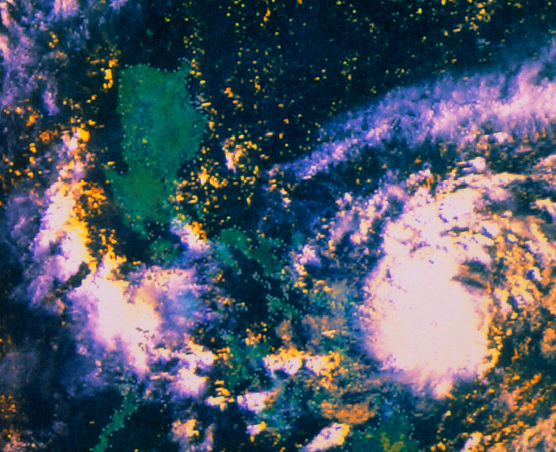
| Typhoon Yunya near the Philippines. Satellite image showing Typhoon Yunya (pale circular feature) approaching the Philippine Islands. The largest island seen here is Luzon (green area left of centre). This image was made on 11 June 1991,five days before the eruption of Mount Pinatubo. Typhoons are tropical cyclonic storms,in which wind speeds may reach 200 kilometres per hour. They form in the Pacific about 5 degrees from the equator,where a large area of ocean surface has a temperature of over 27 degrees Celsius. The data for this image were gathered by the AVHRR radiometer on the NOAA-10 polar-orbiting satellite | |
| Lizenzart: | Lizenzpflichtig |
| Credit: | Science Photo Library / Carey, Robert M. / NOAA |
| Bildgröße: | 4649 px × 3780 px |
| Modell-Rechte: | nicht erforderlich |
| Eigentums-Rechte: | nicht erforderlich |
| Restrictions: |
|
Preise für dieses Bild ab 15 €
Universitäten & Organisationen
(Informationsmaterial Digital, Informationsmaterial Print, Lehrmaterial Digital etc.)
ab 15 €
Redaktionell
(Bücher, Bücher: Sach- und Fachliteratur, Digitale Medien (redaktionell) etc.)
ab 30 €
Werbung
(Anzeigen, Aussenwerbung, Digitale Medien, Fernsehwerbung, Karten, Werbemittel, Zeitschriften etc.)
ab 55 €
Handelsprodukte
(bedruckte Textilie, Kalender, Postkarte, Grußkarte, Verpackung etc.)
ab 75 €
Pauschalpreise
Rechtepakete für die unbeschränkte Bildnutzung in Print oder Online
ab 495 €