Sand storm over Afghanistan
Bildnummer 11737801
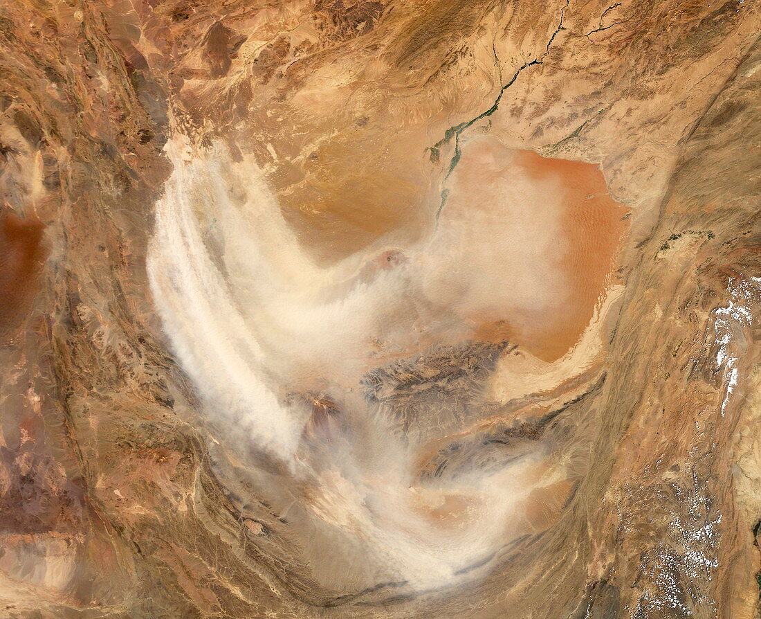
| Dust storm. Satellite image of a dust storm over a large portion of southern Afghanistan and northern Pakistan. The dust is silt from the bottom of the Hamoun's marshes. Once a lush oasis spanning more than 2,000 square kilometres,human mismanagement of the rivers leading to the marshes has converted them to mostly salt flats. Strong winds can easily scoop up the dried silt and carry it for hundreds or thousands or kilometres. Such dust storms appear to be increasing in frequency and severity. Image taken on 17 August 2004 by the Moderate Resolution Imaging Spectroradiometer (MODIS) aboard NASA's Terra satellite | |
| Lizenzart: | Lizenzpflichtig |
| Credit: | Science Photo Library / NASA |
| Bildgröße: | 3200 px × 2600 px |
| Modell-Rechte: | nicht erforderlich |
| Eigentums-Rechte: | nicht erforderlich |
| Restrictions: | - |
Preise für dieses Bild ab 15 €
Universitäten & Organisationen
(Informationsmaterial Digital, Informationsmaterial Print, Lehrmaterial Digital etc.)
ab 15 €
Redaktionell
(Bücher, Bücher: Sach- und Fachliteratur, Digitale Medien (redaktionell) etc.)
ab 30 €
Werbung
(Anzeigen, Aussenwerbung, Digitale Medien, Fernsehwerbung, Karten, Werbemittel, Zeitschriften etc.)
ab 55 €
Handelsprodukte
(bedruckte Textilie, Kalender, Postkarte, Grußkarte, Verpackung etc.)
ab 75 €
Pauschalpreise
Rechtepakete für die unbeschränkte Bildnutzung in Print oder Online
ab 495 €