Antarctic ozone hole,September 2002
Bildnummer 11736371
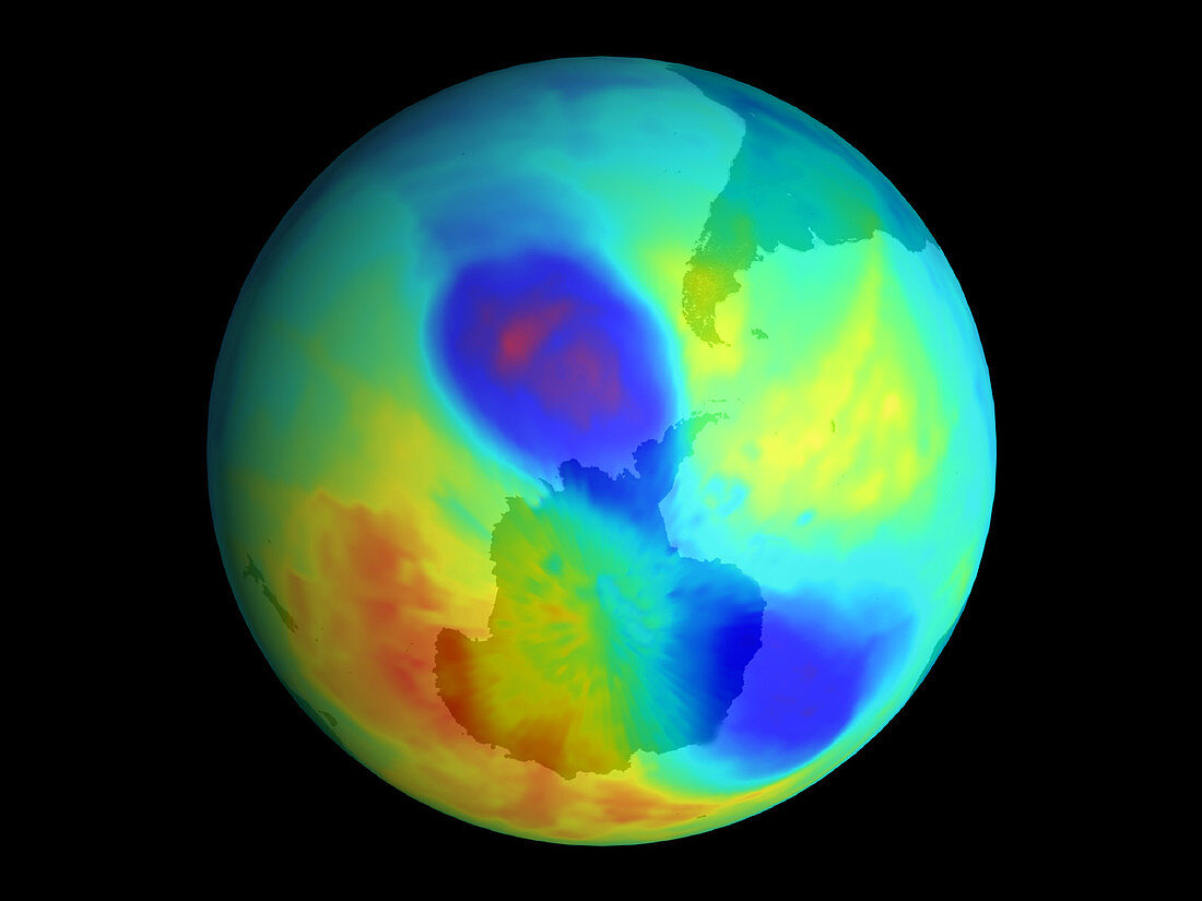
| Ozone hole. Coloured satellite map of the ozone hole over Antarctica on September 24th,2002. Atmospheric ozone levels are colour-coded,from red (highest levels) to blue and violet (lowest levels). The unusual bipolar (two-lobed) structure of the hole is due to unusual weather systems in the stratosphere,the atmospheric layer in which most of the ozone is found. The hole is splitting into two smaller holes here. The total volume of the hole is the smallest since 1988,raising hopes that ozone levels may be increasing. The ozone hole is thought to form due to atmospheric pollution. It is at its worst in the late winter and early spring in the southern hemisphere | |
| Lizenzart: | Lizenzpflichtig |
| Credit: | Science Photo Library / NASA |
| Bildgröße: | 1380 px × 1035 px |
| Modell-Rechte: | nicht erforderlich |
| Eigentums-Rechte: | nicht erforderlich |
| Restrictions: | - |
Preise für dieses Bild ab 15 €
Universitäten & Organisationen
(Informationsmaterial Digital, Informationsmaterial Print, Lehrmaterial Digital etc.)
ab 15 €
Redaktionell
(Bücher, Bücher: Sach- und Fachliteratur, Digitale Medien (redaktionell) etc.)
ab 30 €
Werbung
(Anzeigen, Aussenwerbung, Digitale Medien, Fernsehwerbung, Karten, Werbemittel, Zeitschriften etc.)
ab 55 €
Handelsprodukte
(bedruckte Textilie, Kalender, Postkarte, Grußkarte, Verpackung etc.)
ab 75 €
Pauschalpreise
Rechtepakete für die unbeschränkte Bildnutzung in Print oder Online
ab 495 €