Ozone hole,September 2001
Bildnummer 11736369
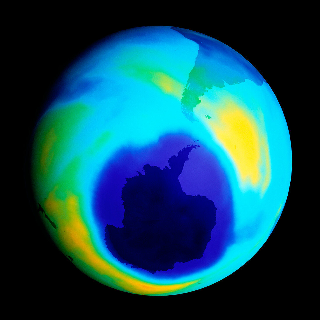
| Antarctic ozone hole. Coloured satellite image of reduced atmospheric ozone levels around Antarctica (lower centre,darkest blue) on 17 September 2001. The ozone hole (dark blue) is at an annual maximum area (26 million square kilometres that year). The ozone levels are colour-coded,ranging from dark blue (low) through light blue and green to yellow (high). Ozone (O3) absorbs dangerous ultraviolet radiation from the Sun. Atmospheric pollution by chlorofluorocarbons (CFCs) and similar compounds reduces ozone levels. The maximal ozone hole size,similar to the 3 previous years,is predicted to slowly decline over future years. Data from the TOMS (Total Ozone Mapping Spectrometer) sensor | |
| Lizenzart: | Lizenzpflichtig |
| Credit: | Science Photo Library / NASA |
| Bildgröße: | 4565 px × 4566 px |
| Modell-Rechte: | nicht erforderlich |
| Eigentums-Rechte: | nicht erforderlich |
| Restrictions: | - |
Preise für dieses Bild ab 15 €
Universitäten & Organisationen
(Informationsmaterial Digital, Informationsmaterial Print, Lehrmaterial Digital etc.)
ab 15 €
Redaktionell
(Bücher, Bücher: Sach- und Fachliteratur, Digitale Medien (redaktionell) etc.)
ab 30 €
Werbung
(Anzeigen, Aussenwerbung, Digitale Medien, Fernsehwerbung, Karten, Werbemittel, Zeitschriften etc.)
ab 55 €
Handelsprodukte
(bedruckte Textilie, Kalender, Postkarte, Grußkarte, Verpackung etc.)
ab 75 €
Pauschalpreise
Rechtepakete für die unbeschränkte Bildnutzung in Print oder Online
ab 495 €
Keywords
- Antarktis,
- Atmosphäre,
- atmosphärisch,
- Beschädigt,
- Bild,
- Bilderwelt,
- Computer,
- Erde,
- Erdkunde,
- farbig,
- Forschung,
- Gerundet,
- Gipfel,
- Kreis,
- kreisförmig,
- maximal,
- Modell-,
- Natur,
- Neuseeland,
- polar,
- rund,
- Satellit,
- Schaden,
- stratosphärisch,
- Südamerika,
- Südpol,
- Umwelt,
- verschmutzt,
- Verschmutzung,
- Weltall,
- Wissenschaften