Antarctic ozone depletion
Bildnummer 11736356
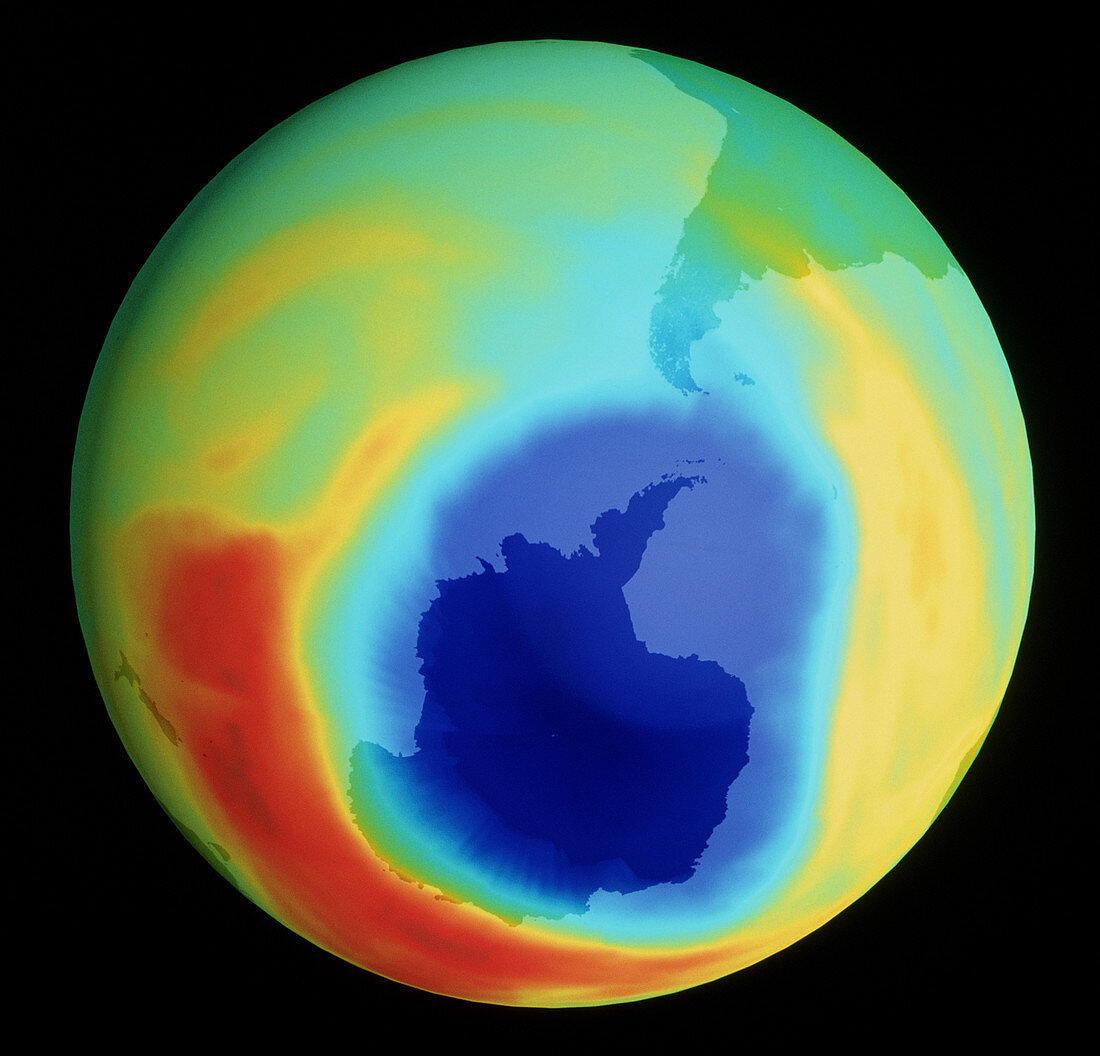
| Ozone depletion over Antarctica (1998). Coloured satellite map of atmospheric ozone in the southern hemisphere between mid-August and early October 1998. An ozone "hole" is seen over Antarctica. Depletion of ozone reached a record size of 10.5 million square miles on 19-09-98; ozone levels fell to 90 Dobson units on 30-09-98,one of the lowest recorded. Colour-coding in Dobson Units (DU): yellow to red (300-340 DU),green to blue (280-200 DU),dark blue (200-100 DU). The ozone hole is due to atmospheric pollution,reaching a maximum around October,the Antarctic spring. Data from the TOMS instrument aboard TOMS-EP satellite; and the SBUV instrument aboard NOAA-14 satellite | |
| Lizenzart: | Lizenzpflichtig |
| Credit: | Science Photo Library / NASA |
| Bildgröße: | 3819 px × 3667 px |
| Modell-Rechte: | nicht erforderlich |
| Eigentums-Rechte: | nicht erforderlich |
| Restrictions: | - |
Preise für dieses Bild ab 15 €
Universitäten & Organisationen
(Informationsmaterial Digital, Informationsmaterial Print, Lehrmaterial Digital etc.)
ab 15 €
Redaktionell
(Bücher, Bücher: Sach- und Fachliteratur, Digitale Medien (redaktionell) etc.)
ab 30 €
Werbung
(Anzeigen, Aussenwerbung, Digitale Medien, Fernsehwerbung, Karten, Werbemittel, Zeitschriften etc.)
ab 55 €
Handelsprodukte
(bedruckte Textilie, Kalender, Postkarte, Grußkarte, Verpackung etc.)
ab 75 €
Pauschalpreise
Rechtepakete für die unbeschränkte Bildnutzung in Print oder Online
ab 495 €