Ozone hole over Antarctica,October 1995
Bildnummer 11736348
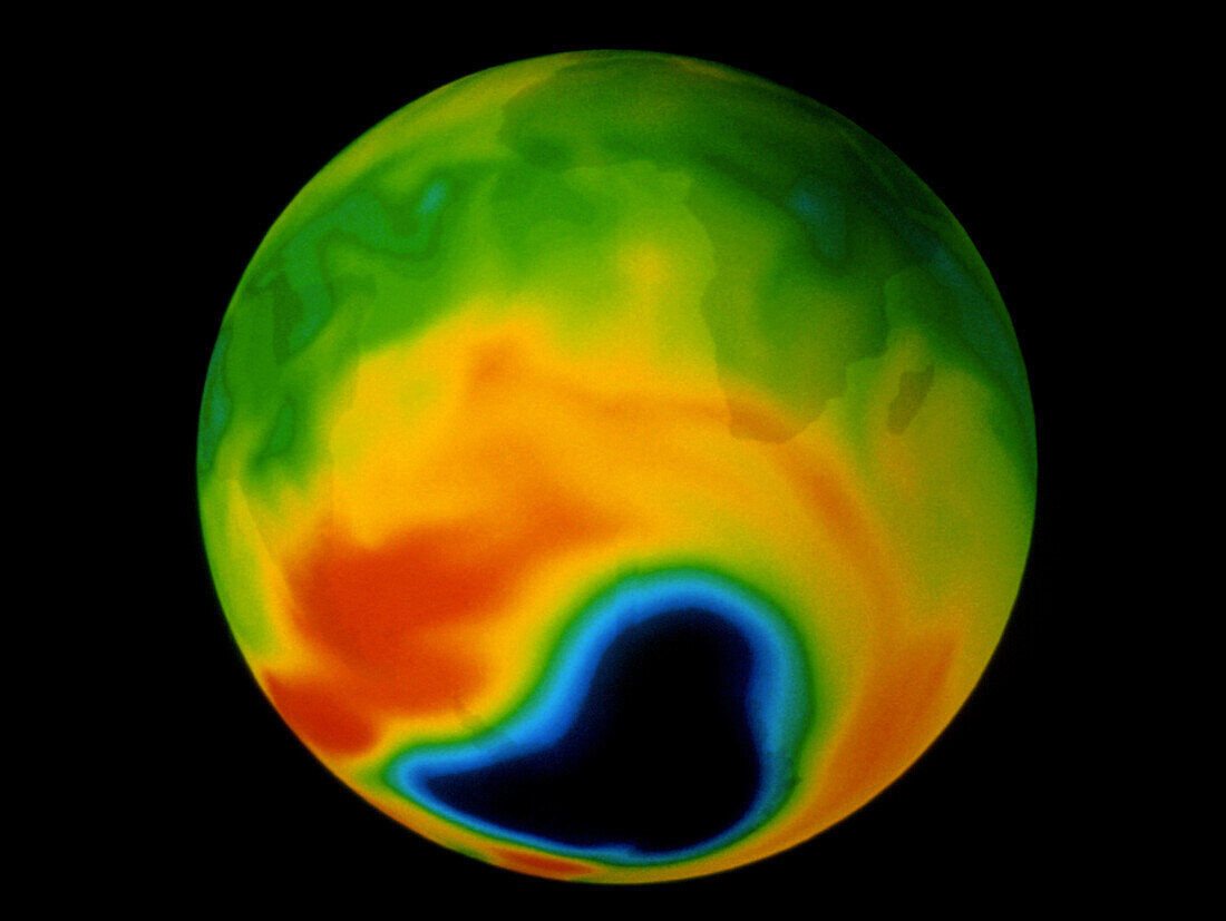
| Antarctic ozone hole (7-10-1995). ERS-2 satellite map of atmospheric ozone in the southern hemisphere on 7 October 1995. Colour coding represents ozone concentration in Dobson Units (DU): yellow to red (300-340 DU),green to blue (280-200 DU),black (140 DU or less). Continents of Africa,South America and Antarctica are superimposed. Ozone levels are very low over Antarctica. This ozone hole develops each year during the Antarctic spring (September to October) and can deepen to values below 100 DU. Satellite data obtained for GOME (Global Ozone Mapping Experiment) | |
| Lizenzart: | Lizenzpflichtig |
| Credit: | Science Photo Library / ESA |
| Bildgröße: | 3543 px × 2663 px |
| Modell-Rechte: | nicht erforderlich |
| Eigentums-Rechte: | nicht erforderlich |
| Restrictions: |
|
Preise für dieses Bild ab 15 €
Universitäten & Organisationen
(Informationsmaterial Digital, Informationsmaterial Print, Lehrmaterial Digital etc.)
ab 15 €
Redaktionell
(Bücher, Bücher: Sach- und Fachliteratur, Digitale Medien (redaktionell) etc.)
ab 30 €
Werbung
(Anzeigen, Aussenwerbung, Digitale Medien, Fernsehwerbung, Karten, Werbemittel, Zeitschriften etc.)
ab 55 €
Handelsprodukte
(bedruckte Textilie, Kalender, Postkarte, Grußkarte, Verpackung etc.)
ab 75 €
Pauschalpreise
Rechtepakete für die unbeschränkte Bildnutzung in Print oder Online
ab 495 €