British Isles from space
Bildnummer 11736177
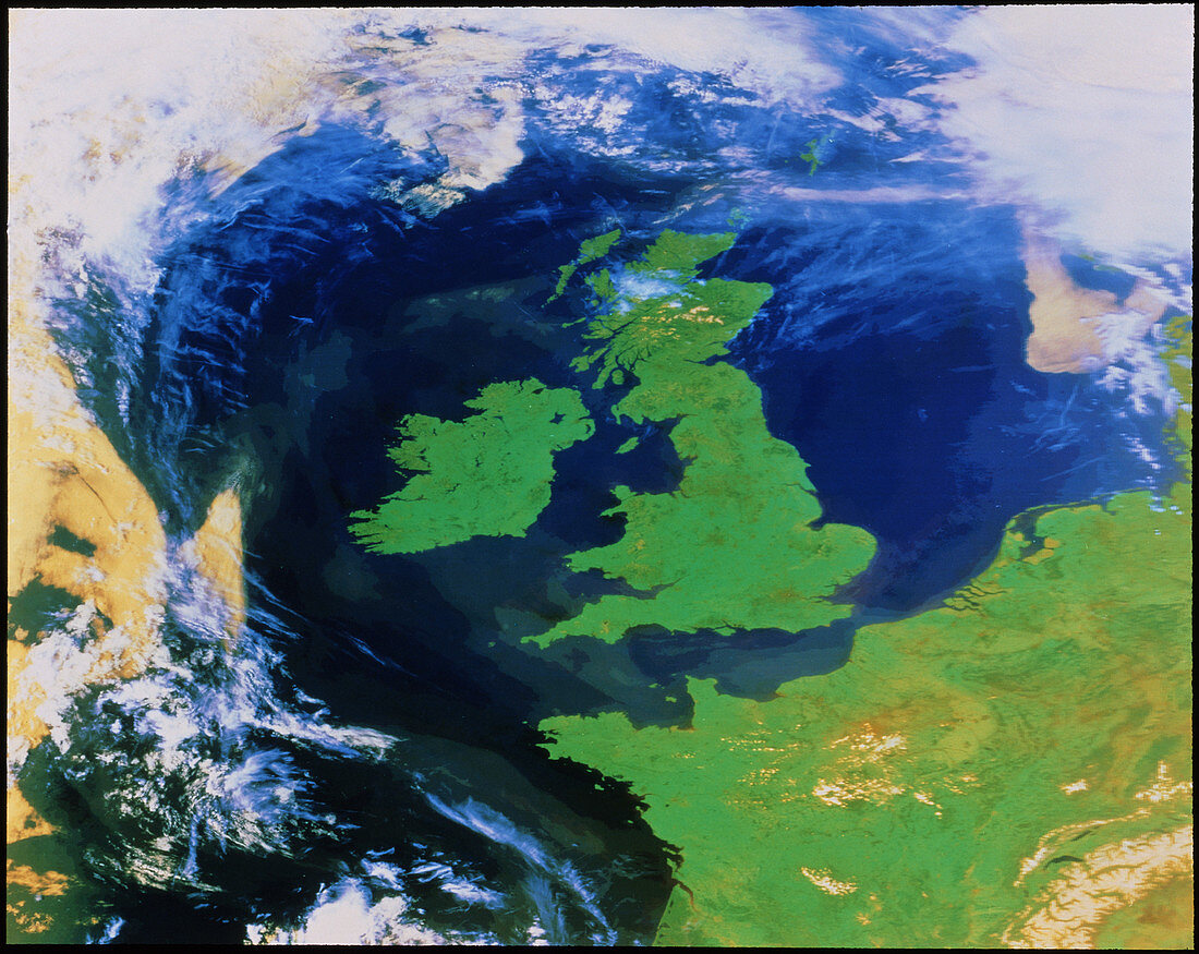
| False-colour satellite image of the British Isles and north-west Europe captured on a relatively cloud-free day. The whole of the UK and Ireland is visible,as is part of France,the Benelux countries and some of Denmark. Snow may be seen on the Alps at bottom right. The clouds that may be seen are in the far north along the north polar front,and in the Atlantic (left) where low-level cloud and fog dominate. This image was made using data from the NOAA 7 weather satellite on 23 April 1984 | |
| Lizenzart: | Lizenzpflichtig |
| Credit: | Science Photo Library / NRSC LTD |
| Bildgröße: | 4147 px × 3297 px |
| Modell-Rechte: | nicht erforderlich |
| Eigentums-Rechte: | nicht erforderlich |
| Restrictions: | - |
Preise für dieses Bild ab 15 €
Universitäten & Organisationen
(Informationsmaterial Digital, Informationsmaterial Print, Lehrmaterial Digital etc.)
ab 15 €
Redaktionell
(Bücher, Bücher: Sach- und Fachliteratur, Digitale Medien (redaktionell) etc.)
ab 30 €
Werbung
(Anzeigen, Aussenwerbung, Digitale Medien, Fernsehwerbung, Karten, Werbemittel, Zeitschriften etc.)
ab 55 €
Handelsprodukte
(bedruckte Textilie, Kalender, Postkarte, Grußkarte, Verpackung etc.)
ab 75 €
Pauschalpreise
Rechtepakete für die unbeschränkte Bildnutzung in Print oder Online
ab 495 €