Landsat mosaic of United Kingdom
Bildnummer 11736170
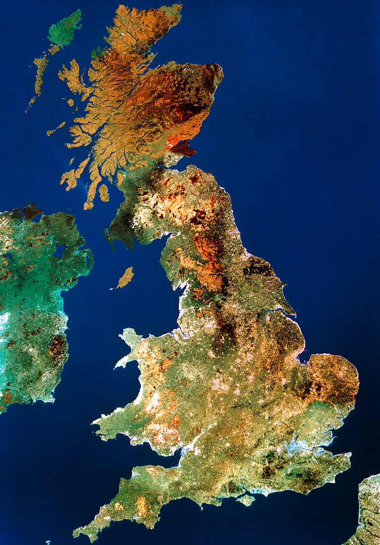
| Landsat real colour mosaic of the United Kingdom,showing parts of France and Ireland. The mosaic is a compilation of 42 separate scenes from data provided by the Thematic Mapper (TM) instrument onboard the Landsat satellite,which orbits Earth at an altitude of 900 kilometres. This image is copyright of Maptec International Ltd.,Dublin,1987 | |
| Lizenzart: | Lizenzpflichtig |
| Credit: | Science Photo Library / Maptec International |
| Bildgröße: | 3541 px × 5079 px |
| Modell-Rechte: | nicht erforderlich |
| Eigentums-Rechte: | nicht erforderlich |
| Restrictions: | - |
Preise für dieses Bild ab 15 €
Universitäten & Organisationen
(Informationsmaterial Digital, Informationsmaterial Print, Lehrmaterial Digital etc.)
ab 15 €
Redaktionell
(Bücher, Bücher: Sach- und Fachliteratur, Digitale Medien (redaktionell) etc.)
ab 30 €
Werbung
(Anzeigen, Aussenwerbung, Digitale Medien, Fernsehwerbung, Karten, Werbemittel, Zeitschriften etc.)
ab 55 €
Handelsprodukte
(bedruckte Textilie, Kalender, Postkarte, Grußkarte, Verpackung etc.)
ab 75 €
Pauschalpreise
Rechtepakete für die unbeschränkte Bildnutzung in Print oder Online
ab 495 €