Satellite image of Baden-Wurttemberg,Germany
Bildnummer 11736038
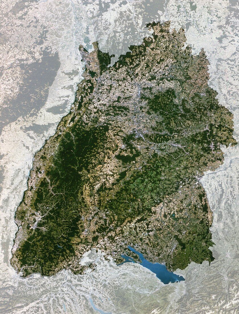
| Baden-Wurttemburg. True-colour satellite image of Baden-Wurttemburg (highlighted),one of Germany's 16 states (Lander). North is at top. The Black Forest (lower left) and other woodlands are dark green,grazing lands are light green and crops are mostly yellow. Urban areas such as Stuttgart (upper centre) & Mannheim (top left) are grey. Bare ground appears pale yellow or brown,almost white. The lake (blue) in the southeast is Lake Constance (Bodensee). The River Rhine flows along Baden-Wurttemburg's western border. Image taken by the American Landsat-5 satellite. The smallest visible features are about 30 metres across | |
| Lizenzart: | Lizenzpflichtig |
| Credit: | Science Photo Library / Planetobserver |
| Bildgröße: | 3800 px × 4977 px |
| Modell-Rechte: | nicht erforderlich |
| Eigentums-Rechte: | nicht erforderlich |
| Restrictions: | - |
Preise für dieses Bild ab 15 €
Universitäten & Organisationen
(Informationsmaterial Digital, Informationsmaterial Print, Lehrmaterial Digital etc.)
ab 15 €
Redaktionell
(Bücher, Bücher: Sach- und Fachliteratur, Digitale Medien (redaktionell) etc.)
ab 30 €
Werbung
(Anzeigen, Aussenwerbung, Digitale Medien, Fernsehwerbung, Karten, Werbemittel, Zeitschriften etc.)
ab 55 €
Handelsprodukte
(bedruckte Textilie, Kalender, Postkarte, Grußkarte, Verpackung etc.)
ab 75 €
Pauschalpreise
Rechtepakete für die unbeschränkte Bildnutzung in Print oder Online
ab 495 €