Western Sahara Berm,satellite image
Bildnummer 11735955
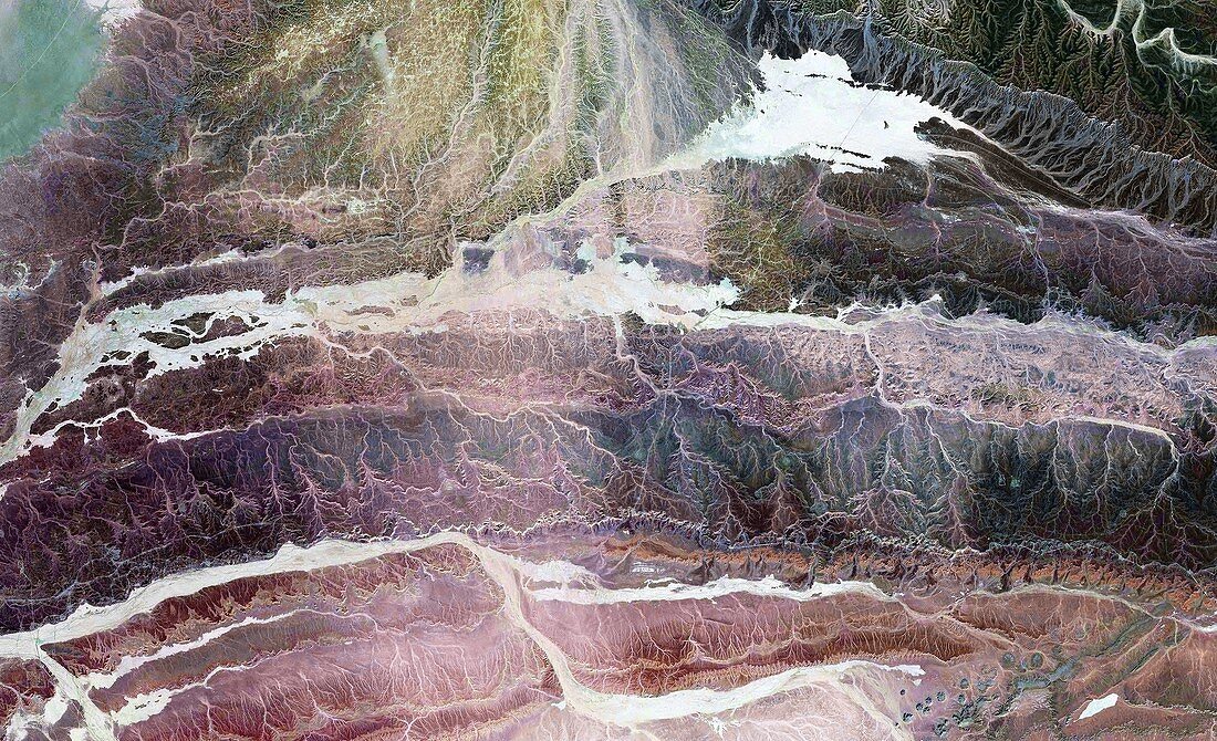
| Western Sahara Berm. Landsat satellite image showing the Western Sahara Berm,or Moroccan wall (white). North is at top. The Berm actually consists of six walls,which were built between 1981 and 1987. They were built by the Moroccan government to separate the Moroccan-controlled area of Western Sahara from territory (to the east) held by the Polisario Front,who want independence for Western Sahara | |
| Lizenzart: | Lizenzpflichtig |
| Credit: | Science Photo Library / NASA |
| Bildgröße: | 6247 px × 3805 px |
| Modell-Rechte: | nicht erforderlich |
| Eigentums-Rechte: | nicht erforderlich |
| Restrictions: | - |
Preise für dieses Bild ab 15 €
Universitäten & Organisationen
(Informationsmaterial Digital, Informationsmaterial Print, Lehrmaterial Digital etc.)
ab 15 €
Redaktionell
(Bücher, Bücher: Sach- und Fachliteratur, Digitale Medien (redaktionell) etc.)
ab 30 €
Werbung
(Anzeigen, Aussenwerbung, Digitale Medien, Fernsehwerbung, Karten, Werbemittel, Zeitschriften etc.)
ab 55 €
Handelsprodukte
(bedruckte Textilie, Kalender, Postkarte, Grußkarte, Verpackung etc.)
ab 75 €
Pauschalpreise
Rechtepakete für die unbeschränkte Bildnutzung in Print oder Online
ab 495 €
Keywords
- 1900er Jahre,
- 1980er Jahre,
- 20. Jahrhundert,
- Afrika,
- Afrikanisch,
- Atlantischer Ozean,
- Bild,
- Bilder,
- Erdbeobachtung,
- Erdkunde,
- Foto,
- Fotos,
- geografisch,
- Geographie,
- Geschichte,
- Grenze,
- historisch,
- Konflikt,
- künstlich,
- künstlich hergestellt,
- Küste,
- Land,
- Marokko,
- Mauer,
- Politik,
- politisch,
- Rand,
- Satellitenbild,
- Separieren,
- Wände,
- Weltall,
- Wissenschaften