Asia
Bildnummer 11735896
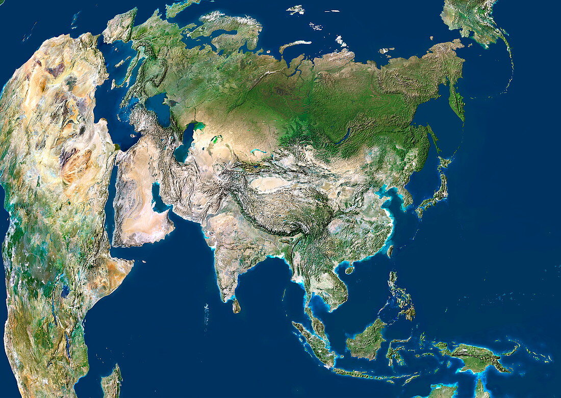
| Asia. Satellite image centred on Asia,with nearly all of Africa (down left) and Europe (upper left) seen. This image shows the curvature of the Earth,with north-south lines converging towards top. Water is blue,vegetation is green,arid areas are brown,and snow and ice are white. The terrain of Asia varies from deserts (brown,central and southern Asia),to tropical rainforests (dark green,South-East Asia and the Malay Archipelago),to grasslands,forests and tundra (lighter green,northern Asia),and mountain ranges (centre). Also seen is the Arctic (top),Alaska (top right),and the Pacific Ocean (right) and Indian Ocean (lower left). For this area at night,see E074/053 | |
| Lizenzart: | Lizenzpflichtig |
| Credit: | Science Photo Library / Planetobserver |
| Bildgröße: | 4943 px × 3508 px |
| Modell-Rechte: | nicht erforderlich |
| Eigentums-Rechte: | nicht erforderlich |
| Restrictions: | - |
Preise für dieses Bild ab 15 €
Universitäten & Organisationen
(Informationsmaterial Digital, Informationsmaterial Print, Lehrmaterial Digital etc.)
ab 15 €
Redaktionell
(Bücher, Bücher: Sach- und Fachliteratur, Digitale Medien (redaktionell) etc.)
ab 30 €
Werbung
(Anzeigen, Aussenwerbung, Digitale Medien, Fernsehwerbung, Karten, Werbemittel, Zeitschriften etc.)
ab 55 €
Handelsprodukte
(bedruckte Textilie, Kalender, Postkarte, Grußkarte, Verpackung etc.)
ab 75 €
Pauschalpreise
Rechtepakete für die unbeschränkte Bildnutzung in Print oder Online
ab 495 €
Keywords
- Afrika,
- Afrikanisch,
- Arktis,
- Asiatisch,
- Asien,
- Berge,
- China,
- Erdbeobachtung,
- Eurasien,
- Eurasisch,
- Europa,
- europäisch,
- geografisch,
- Geographie,
- Himalaya,
- Indien,
- Indisch,
- Japan,
- Karte,
- Kontinent,
- Land,
- Malaiischer Archipel,
- Meer,
- Mittlerer Osten,
- Ozean,
- Pazifik,
- Russland,
- Satellit,
- Satellitenbild,
- Südostasien,
- Wälder,
- Wasser,
- Weltall