Philippines
Bildnummer 11735852
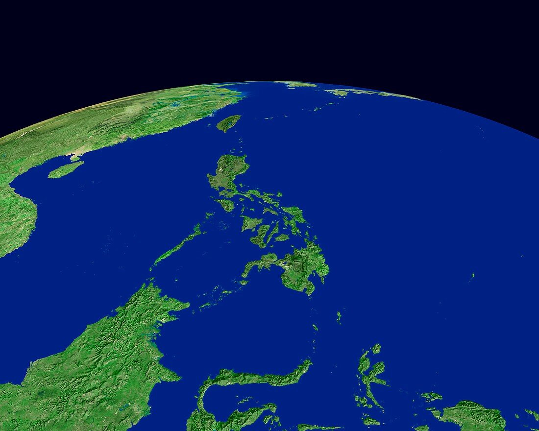
| Philippines and surroundings,satellite image that looks North towards the Earth's curved horizon. The Philippines (centre) lie between the Pacific Ocean (right) and the South China Sea (left),with mainland Asia at top left. The Philippine islands of Mindanao (south) and Luzon (north) are joined by an archipelago of smaller islands. Neighbouring islands include mostly Indonesian islands to the south. Borneo (lower left) is across the Sulu Sea,while Sulawesi (bottom centre) is over the Celebes Sea. All the islands are mountainous and forested | |
| Lizenzart: | Lizenzpflichtig |
| Credit: | Science Photo Library / Worldsat International |
| Bildgröße: | 4200 px × 3360 px |
| Modell-Rechte: | nicht erforderlich |
| Eigentums-Rechte: | nicht erforderlich |
| Restrictions: |
|
Preise für dieses Bild ab 15 €
Universitäten & Organisationen
(Informationsmaterial Digital, Informationsmaterial Print, Lehrmaterial Digital etc.)
ab 15 €
Redaktionell
(Bücher, Bücher: Sach- und Fachliteratur, Digitale Medien (redaktionell) etc.)
ab 30 €
Werbung
(Anzeigen, Aussenwerbung, Digitale Medien, Fernsehwerbung, Karten, Werbemittel, Zeitschriften etc.)
ab 55 €
Handelsprodukte
(bedruckte Textilie, Kalender, Postkarte, Grußkarte, Verpackung etc.)
ab 75 €
Pauschalpreise
Rechtepakete für die unbeschränkte Bildnutzung in Print oder Online
ab 495 €
Keywords
- Asiatisch,
- Asien,
- bewaldet,
- Bild,
- Bilder,
- Bilderwelt,
- China,
- Dschungel,
- Erdbeobachtung,
- Erdkunde,
- Foto,
- Fotos,
- geografisch,
- Geographie,
- hainan,
- Insel,
- Inseln,
- Kambodscha,
- Laos,
- Meer,
- Mindanao,
- optisch,
- Ozean,
- Pazifik,
- Philippinen,
- Satellitenbild,
- Sichtbar,
- Sulawesi,
- Taiwan,
- Thailand,
- topografisch,
- Topographie,
- topographisch,
- Tropen,
- Tropisch,
- Vietnam,
- Wald,
- Wälder,
- Weltall,
- Wissenschaften