Asia
Bildnummer 11735709
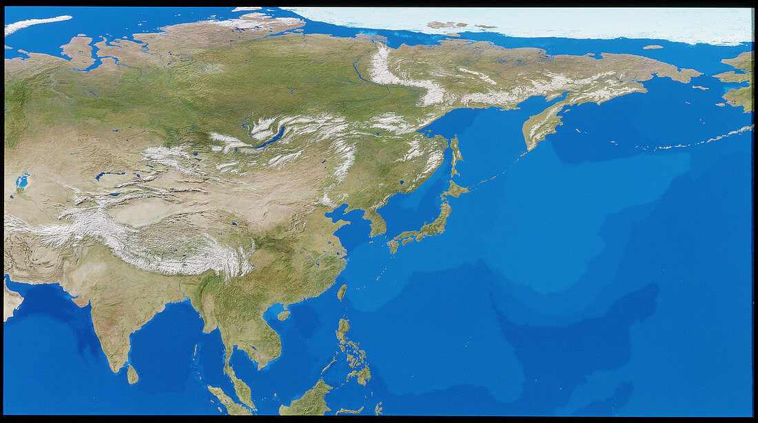
| Asia. Cloudless satellite image of Asia in flat projection; this exaggerates east-west distances in the northernmost part of the image (at top). The colours of the land approximate to natural tones,whilst blue colour-codes represent ocean topography. The snow-capped Himalaya mountains are at lower left. To the northeast of the Himalayas is the Gobi desert. This image was compiled from data acquired by NOAA weather satellites over eleven ten-day periods at an altitude of 833 kilometres to give a resolution of 1 kilometre | |
| Lizenzart: | Lizenzpflichtig |
| Credit: | Science Photo Library / PLANETARY VISIONS / TOM VAN SANT, GEOSPHERE PROJECT |
| Bildgröße: | 5142 px × 2873 px |
| Modell-Rechte: | nicht erforderlich |
| Eigentums-Rechte: | nicht erforderlich |
| Restrictions: |
|
Preise für dieses Bild ab 15 €
Universitäten & Organisationen
(Informationsmaterial Digital, Informationsmaterial Print, Lehrmaterial Digital etc.)
ab 15 €
Redaktionell
(Bücher, Bücher: Sach- und Fachliteratur, Digitale Medien (redaktionell) etc.)
ab 30 €
Werbung
(Anzeigen, Aussenwerbung, Digitale Medien, Fernsehwerbung, Karten, Werbemittel, Zeitschriften etc.)
ab 55 €
Handelsprodukte
(bedruckte Textilie, Kalender, Postkarte, Grußkarte, Verpackung etc.)
ab 75 €
Pauschalpreise
Rechtepakete für die unbeschränkte Bildnutzung in Print oder Online
ab 495 €
Keywords
- Asien,
- Bild,
- Bilder,
- Erdkunde,
- Foto,
- Fotos,
- Himalaya,
- NOAA Bilder,
- Weltall,
- Wissenschaften