Western USA & North America from space
Bildnummer 11735676
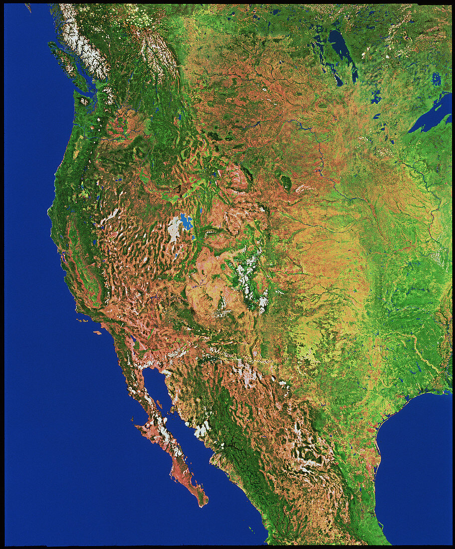
| Western North America. Mosaic of satellite images showing the western half of the continent of North America. Most of the western region is at a high elevation,a result of the destructive tectonic plate boundary along the whole Pacific Coast. The mountains include the Sierra Madre of Mexico (bottom),the Basin Region of Nevada (left) and the Rocky mountains of the USA and Canada (centre to top left). Tectonic forces were also responsible for Mexico's Baja California peninsula (lower left) and the San Joaquin Valley (green,centre left). The data for this image were gathered by NOAA weather satellites | |
| Lizenzart: | Lizenzpflichtig |
| Credit: | Science Photo Library / Worldsat International |
| Bildgröße: | 3479 px × 4196 px |
| Modell-Rechte: | nicht erforderlich |
| Eigentums-Rechte: | nicht erforderlich |
| Restrictions: |
|
Preise für dieses Bild ab 15 €
Universitäten & Organisationen
(Informationsmaterial Digital, Informationsmaterial Print, Lehrmaterial Digital etc.)
ab 15 €
Redaktionell
(Bücher, Bücher: Sach- und Fachliteratur, Digitale Medien (redaktionell) etc.)
ab 30 €
Werbung
(Anzeigen, Aussenwerbung, Digitale Medien, Fernsehwerbung, Karten, Werbemittel, Zeitschriften etc.)
ab 55 €
Handelsprodukte
(bedruckte Textilie, Kalender, Postkarte, Grußkarte, Verpackung etc.)
ab 75 €
Pauschalpreise
Rechtepakete für die unbeschränkte Bildnutzung in Print oder Online
ab 495 €