North America
Bildnummer 11735661
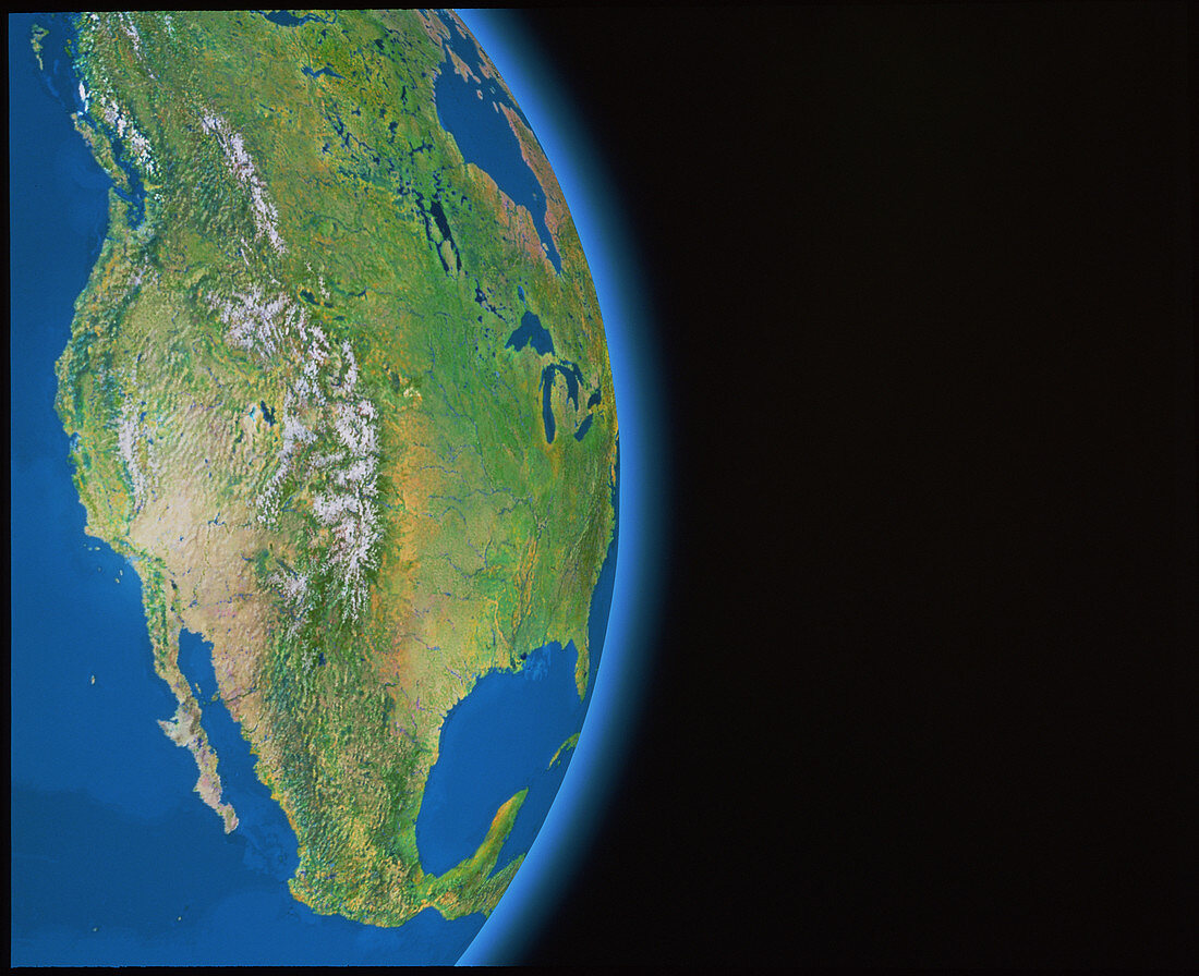
| North America. Satellite mosaic image showing the western seaboard of North America and Mexico. The large island at top left is Vancouver Island,on the Canada-USA border. The large mountain range (white) is the Rockies,with the smaller Sierra Nevada range close to the coast at centre left. Between these is the pale brown of the high deserts of California and Nevada. At lower left is the Baja California peninsula of Mexico. The dark areas in Mexico (bottom) are the Sierra Madre mountains. This image was created from a database of thousands of NOAA weather satellite frames | |
| Lizenzart: | Lizenzpflichtig |
| Credit: | Science Photo Library / GEOSPHERE PROJECT, SANTA MONICA / COPYRIGHT TOM VAN SANT |
| Bildgröße: | 4157 px × 3387 px |
| Modell-Rechte: | nicht erforderlich |
| Eigentums-Rechte: | nicht erforderlich |
| Restrictions: |
|
Preise für dieses Bild ab 15 €
Universitäten & Organisationen
(Informationsmaterial Digital, Informationsmaterial Print, Lehrmaterial Digital etc.)
ab 15 €
Redaktionell
(Bücher, Bücher: Sach- und Fachliteratur, Digitale Medien (redaktionell) etc.)
ab 30 €
Werbung
(Anzeigen, Aussenwerbung, Digitale Medien, Fernsehwerbung, Karten, Werbemittel, Zeitschriften etc.)
ab 55 €
Handelsprodukte
(bedruckte Textilie, Kalender, Postkarte, Grußkarte, Verpackung etc.)
ab 75 €
Pauschalpreise
Rechtepakete für die unbeschränkte Bildnutzung in Print oder Online
ab 495 €