Historical map of Europe and North Africa
Bildnummer 11735559
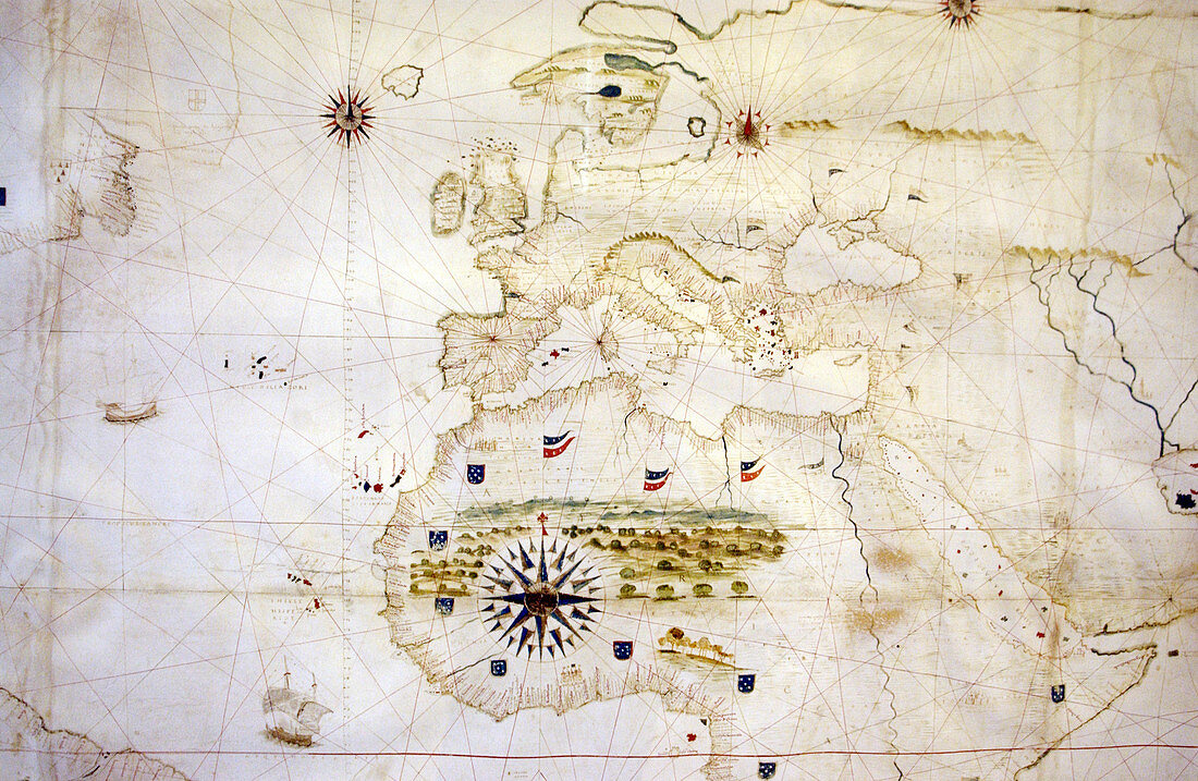
| Historical map of Europe and North Africa. Several compass roses are seen on the map at upper left and upper right,and a large one at lower centre. Flags are dotted around the African coast,showing European exploration and colonisation at the time by France and Spain. Shipping routes are shown in the Atlantic Ocean,the Mediterranean Sea,and the Red Sea. The Canary Islands,the Azores and the Cape Verde Islands are also shown. Photographed in the Vatican City,Rome | |
| Lizenzart: | Lizenzpflichtig |
| Credit: | Science Photo Library / Allen, Steve |
| Bildgröße: | 5075 px × 3307 px |
| Modell-Rechte: | nicht erforderlich |
| Eigentums-Rechte: | nicht erforderlich |
| Restrictions: | - |
Preise für dieses Bild ab 15 €
Universitäten & Organisationen
(Informationsmaterial Digital, Informationsmaterial Print, Lehrmaterial Digital etc.)
ab 15 €
Redaktionell
(Bücher, Bücher: Sach- und Fachliteratur, Digitale Medien (redaktionell) etc.)
ab 30 €
Werbung
(Anzeigen, Aussenwerbung, Digitale Medien, Fernsehwerbung, Karten, Werbemittel, Zeitschriften etc.)
ab 55 €
Handelsprodukte
(bedruckte Textilie, Kalender, Postkarte, Grußkarte, Verpackung etc.)
ab 75 €
Pauschalpreise
Rechtepakete für die unbeschränkte Bildnutzung in Print oder Online
ab 495 €
Keywords
- Afrikanisch,
- Alt,
- Alter,
- Atlantischer Ozean,
- Azoren,
- Erkundung,
- Europa,
- europäisch,
- Flagge,
- Flaggen,
- Französisch,
- geografisch,
- Geographie,
- Geschichte,
- Hafen,
- Häfen,
- historisch,
- Italienisch,
- Kanarische Inseln,
- Karte,
- Kartographie,
- Kolonien,
- Kontinent,
- Küste,
- Küsten-,
- Land,
- Linien,
- Maritim,
- Meer,
- Mittelalterlich,
- Mittelmeer,
- mittleren Alters,
- Nation,
- Navigation,
- Nordafrika,
- Ozean,
- Rom,
- Rosen,
- Rotes Meer,
- spanisch