Ortelius's map of the British Isles,1570
Bildnummer 11735537
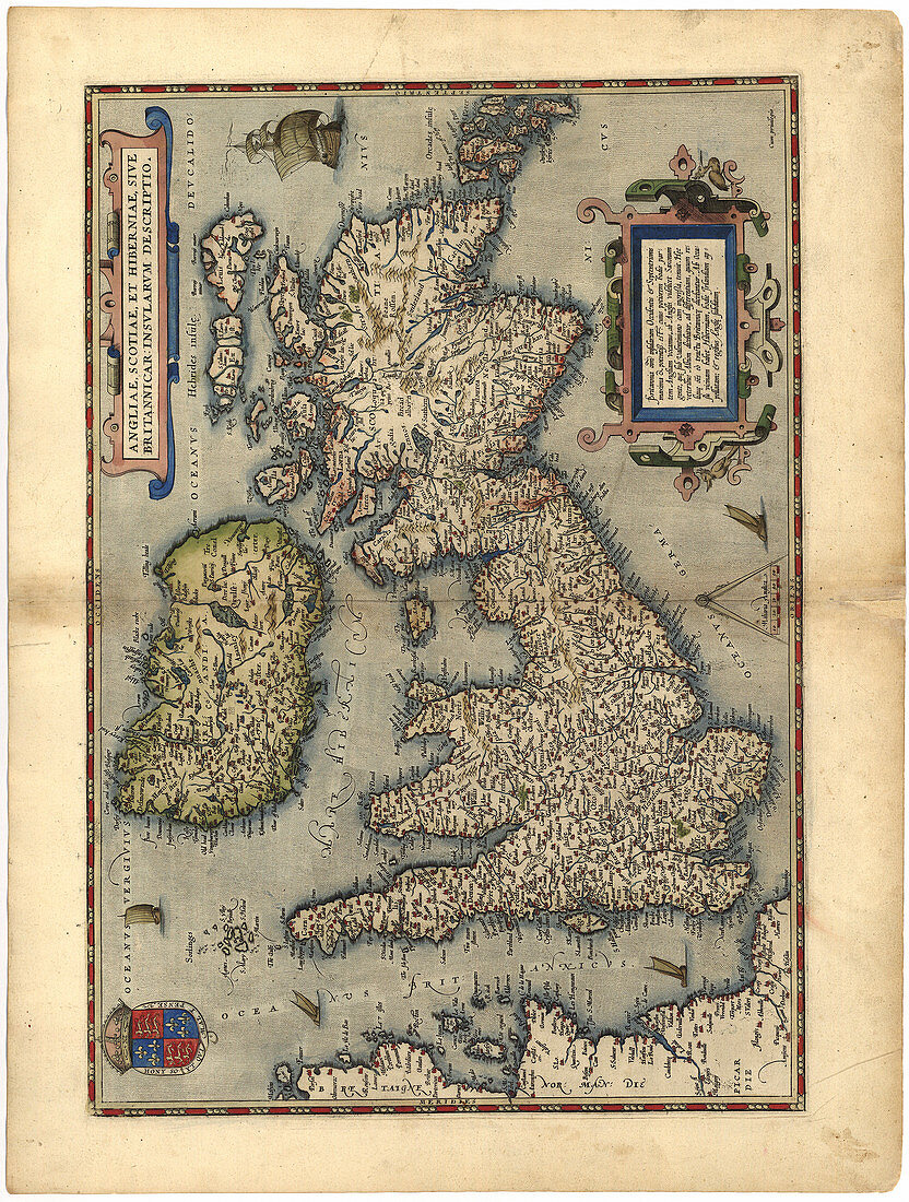
| Map of the British Isles,in the 1570 edition of Ortelius Atlas (Theatrum Orbis Terrarum). Abraham Ortelius (1527-1598) was a Flemish mapmaker who is considered to have produced the first true atlas (collection of uniform maps in one book). Ortelius worked in Antwerp,the Netherlands. This map is titled: Angliae,Scotiae et Hiberniae (England,Scotland and Ireland). The text at upper right is in Latin and mentions Saxons and Albion (another term for Britain). A royal coat of arms is seen at lower left | |
| Lizenzart: | Lizenzpflichtig |
| Credit: | Science Photo Library / LIBRARY OF CONGRESS, GEOGRAPHY AND MAP DIVISION |
| Bildgröße: | 4009 px × 5300 px |
| Modell-Rechte: | nicht erforderlich |
| Eigentums-Rechte: | nicht erforderlich |
| Restrictions: | - |
Preise für dieses Bild ab 15 €
Universitäten & Organisationen
(Informationsmaterial Digital, Informationsmaterial Print, Lehrmaterial Digital etc.)
ab 15 €
Redaktionell
(Bücher, Bücher: Sach- und Fachliteratur, Digitale Medien (redaktionell) etc.)
ab 30 €
Werbung
(Anzeigen, Aussenwerbung, Digitale Medien, Fernsehwerbung, Karten, Werbemittel, Zeitschriften etc.)
ab 55 €
Handelsprodukte
(bedruckte Textilie, Kalender, Postkarte, Grußkarte, Verpackung etc.)
ab 75 €
Pauschalpreise
Rechtepakete für die unbeschränkte Bildnutzung in Print oder Online
ab 495 €
Keywords
- 1500er Jahre,
- 16. Jahrhundert,
- Abraham Ortelius,
- Alt,
- Alter,
- britisch,
- Britische Inseln,
- Diagramm,
- England,
- Englisch,
- Flämisch,
- geografisch,
- Geographie,
- Geschichte,
- Großbritannien,
- historisch,
- Illustration,
- illustriert,
- Irisch,
- Irland,
- Karte,
- Kartographie,
- Kunstwerk,
- Land,
- Latein,
- Nation,
- Niederländisch,
- Renaissance,
- schottisch,
- Schottland,
- Theatrum orbis terrarum,
- Unvollständig,
- Vereinigtes Königreich,
- Wales,
- Walisisch,
- Wappen