West Indies,17th century
Bildnummer 11730649
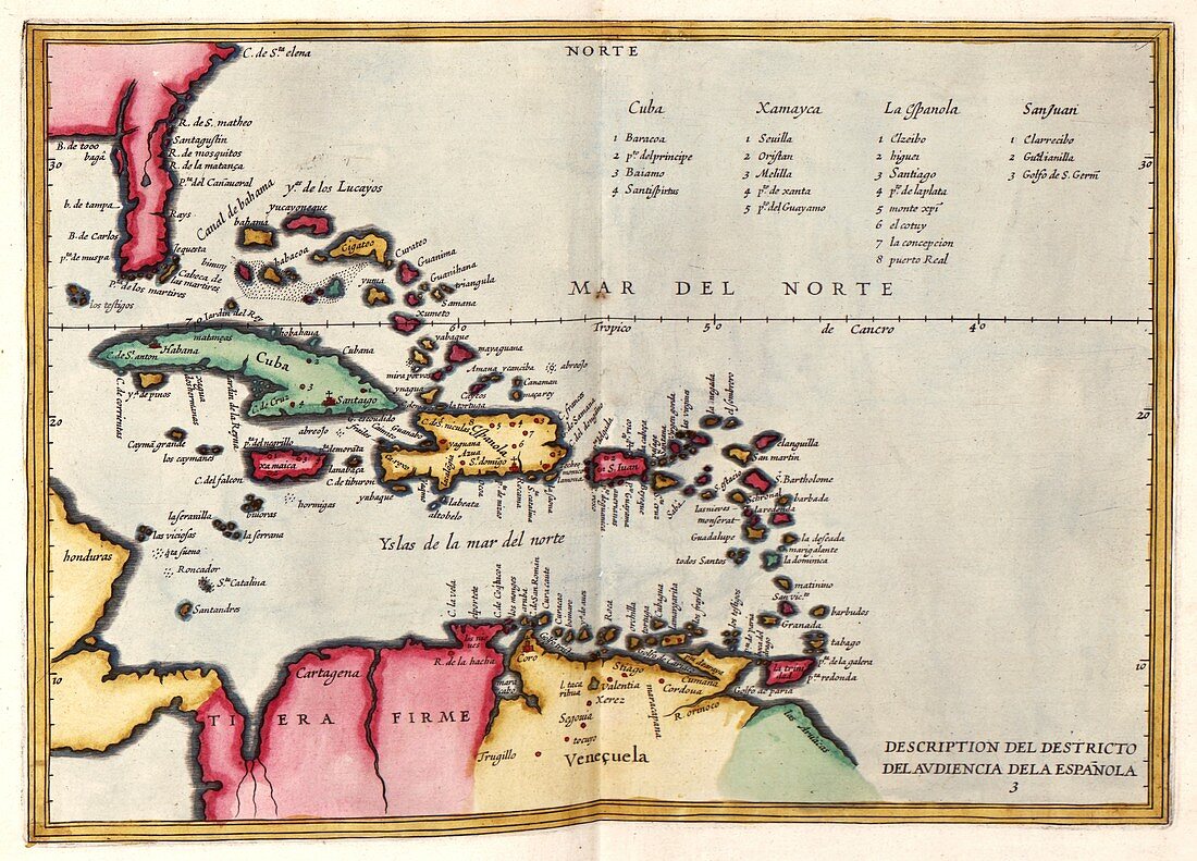
| West Indies. 17th-century map of the West Indies and the islands of the Caribbean Sea,with the Tropic of Cancer. The West Indies was used to refer to the lands discovered by Columbus and other European explorers travelling west to what became known as the New World or the Americas. Major islands shown here include Cuba,Xamayca (Jamaica),La Espanola (Hispaniola) and San Juan (Puerto Rico). This map is from 'Descriptio Indiae Occidentale' in 'Nieuwe werelt' (1622),a Dutch republication of an earlier 1601 work by Spanish historian Antonio de Herrera y Tordesillas (1549-1626). This Dutch edition was published in Amsterdam by Michiel Colijn | |
| Lizenzart: | Lizenzpflichtig |
| Credit: | Science Photo Library / LIBRARY OF CONGRESS, Geography and Map Division |
| Bildgröße: | 4931 px × 3548 px |
| Modell-Rechte: | nicht erforderlich |
| Eigentums-Rechte: | nicht erforderlich |
| Restrictions: | - |
Preise für dieses Bild ab 15 €
Universitäten & Organisationen
(Informationsmaterial Digital, Informationsmaterial Print, Lehrmaterial Digital etc.)
ab 15 €
Redaktionell
(Bücher, Bücher: Sach- und Fachliteratur, Digitale Medien (redaktionell) etc.)
ab 30 €
Werbung
(Anzeigen, Aussenwerbung, Digitale Medien, Fernsehwerbung, Karten, Werbemittel, Zeitschriften etc.)
ab 55 €
Handelsprodukte
(bedruckte Textilie, Kalender, Postkarte, Grußkarte, Verpackung etc.)
ab 75 €
Pauschalpreise
Rechtepakete für die unbeschränkte Bildnutzung in Print oder Online
ab 495 €
Keywords
- 1600er Jahre,
- 17. Jahrhundert,
- Antigua,
- Aruba,
- Atlantischer Ozean,
- Atlas,
- Bahamas,
- Barbados,
- Britische Jungferninseln,
- Cayman Inseln,
- Curacao,
- Diagramm,
- Dominica,
- Dominikanische Republik,
- Florida,
- geografisch,
- Geographie,
- Geschichte,
- Grenada,
- historisch,
- Honduras,
- Illustration,
- Insel,
- Inseln,
- Jamaika,
- Karibisches Meer,
- Karte,
- Kartographie,
- Kolumbien,
- Kuba,
- Kunstwerk,
- Martinique,
- Mexiko,
- Neue Welt,
- Niederländisch,
- Niemand,
- Nordamerika,
- nordamerikanisch,
- Puerto Rico,
- Region,
- San Juan,
- spanisch,
- Südamerika,
- Südamerikanisch,
- Tobago,
- Trinidad,
- Venezuela,
- Veröffentlichung,
- Westindische Inseln