Saunders Island volcano,bathymetry
Bildnummer 11728152
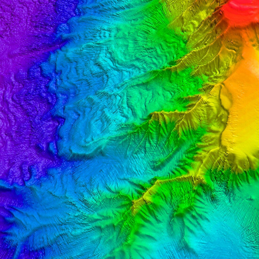
| Saunders Island volcano,bathymetry. Map of ocean floor depth (bathymetry) north east of Saunders Island,South Sandwich Islands,in the southern Atlantic Ocean. Depth is colour-coded from shallow (red) to deep (purple). Deeply-eroded canyons are funnelling sediment down the slope of this active volcanic and glaciated island. Wave fields of the sediment can be seen across the slope. This high sedimentation rate indicates high erosion rates of the island. Data acquired by the hull-mounted Simrad EM120 multibeam echo-sounder on RRS James Clark Ross during BAS cruise JR206 between January and March 2010 | |
| Lizenzart: | Lizenzpflichtig |
| Credit: | Science Photo Library / Pete Bucktrout, BRITISH ANTARCTIC SURVEY / Philip Leat |
| Bildgröße: | 4594 px × 4594 px |
| Modell-Rechte: | nicht erforderlich |
| Eigentums-Rechte: | nicht erforderlich |
| Restrictions: | - |
Preise für dieses Bild ab 15 €
Universitäten & Organisationen
(Informationsmaterial Digital, Informationsmaterial Print, Lehrmaterial Digital etc.)
ab 15 €
Redaktionell
(Bücher, Bücher: Sach- und Fachliteratur, Digitale Medien (redaktionell) etc.)
ab 30 €
Werbung
(Anzeigen, Aussenwerbung, Digitale Medien, Fernsehwerbung, Karten, Werbemittel, Zeitschriften etc.)
ab 55 €
Handelsprodukte
(bedruckte Textilie, Kalender, Postkarte, Grußkarte, Verpackung etc.)
ab 75 €
Pauschalpreise
Rechtepakete für die unbeschränkte Bildnutzung in Print oder Online
ab 495 €