Map of Africa,17th century
Bildnummer 11727734
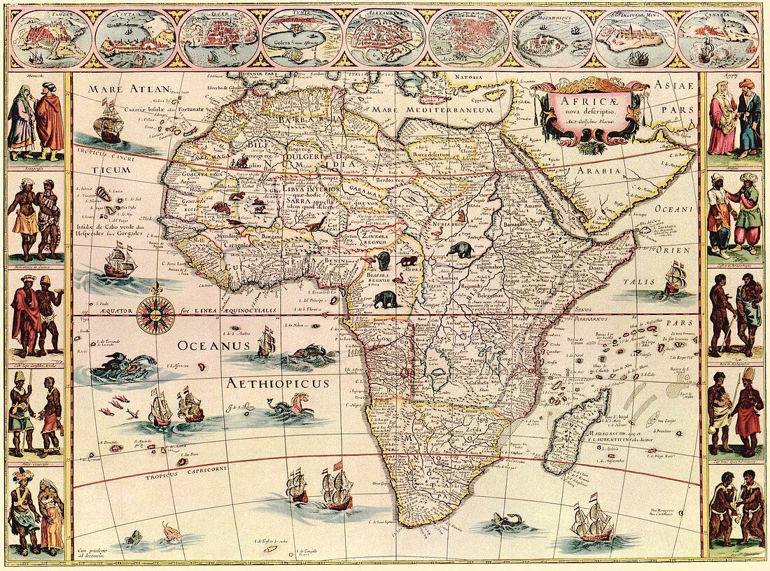
| Map of Africa. 17th-century map of the continent of Africa,with illustrations of major cities (across top) and indigenous peoples (down left and right). Animals (elephants,monkeys,ostriches,gazelles,lions,cheetahs and camels) are shown on land,with ships and sea creatures in the oceans. The labels are in Latin,as is the title: 'Africae nova descriptio'. The nine cities across top are (from left): Tangier,Ceuta,Algiers,Tunis,Alexandria,Cairo (Alcair),the island of Mozambique,the mine at St George in Guinea,and Canaria (Canary Islands). This 1640 map by Dutch map-maker Willem Janszoon Blaeu (1571-1638) was published in Amsterdam in the 1660s | |
| Lizenzart: | Lizenzpflichtig |
| Credit: | Science Photo Library / LIBRARY OF CONGRESS, Geography and Map Division |
| Bildgröße: | 3473 px × 2575 px |
| Modell-Rechte: | nicht erforderlich |
| Eigentums-Rechte: | nicht erforderlich |
| Restrictions: | - |
Preise für dieses Bild ab 15 €
Universitäten & Organisationen
(Informationsmaterial Digital, Informationsmaterial Print, Lehrmaterial Digital etc.)
ab 15 €
Redaktionell
(Bücher, Bücher: Sach- und Fachliteratur, Digitale Medien (redaktionell) etc.)
ab 30 €
Werbung
(Anzeigen, Aussenwerbung, Digitale Medien, Fernsehwerbung, Karten, Werbemittel, Zeitschriften etc.)
ab 55 €
Handelsprodukte
(bedruckte Textilie, Kalender, Postkarte, Grußkarte, Verpackung etc.)
ab 75 €
Pauschalpreise
Rechtepakete für die unbeschränkte Bildnutzung in Print oder Online
ab 495 €
Keywords
- 1600er Jahre,
- 17. Jahrhundert,
- Affen,
- Afrika,
- Afrikanisch,
- Ägypter,
- Alexandria,
- Algier,
- Anthropologie,
- anthropologisch,
- Bergwerk,
- beschriftet,
- Biologie,
- biologisch,
- Elefanten,
- Erwachsene,
- Etikette,
- Etiketten,
- Fauna,
- Fliegender Fisch,
- Frau,
- geografisch,
- Geographie,
- Geschichte,
- historisch,
- Illustration,
- Kairo,
- Kamele,
- Kanarische Inseln,
- Karte,
- Kartographie,
- Kontinent,
- Kunstwerk,
- Latein,
- Löwen,
- Mann,
- Männlich,
- Meereskunde,
- Mensch,
- Natur,
- Niemand,
- Schiffe,
- schwarz,
- Segelschiffe,
- Senegalesisch,
- Stadt,
- Städte,
- Strauße,
- Text,
- Tier,
- Tierwelt,
- Weiblich,
- Zoologie,
- zoologisch