Chinese river embankments,18th century
Bildnummer 11727689
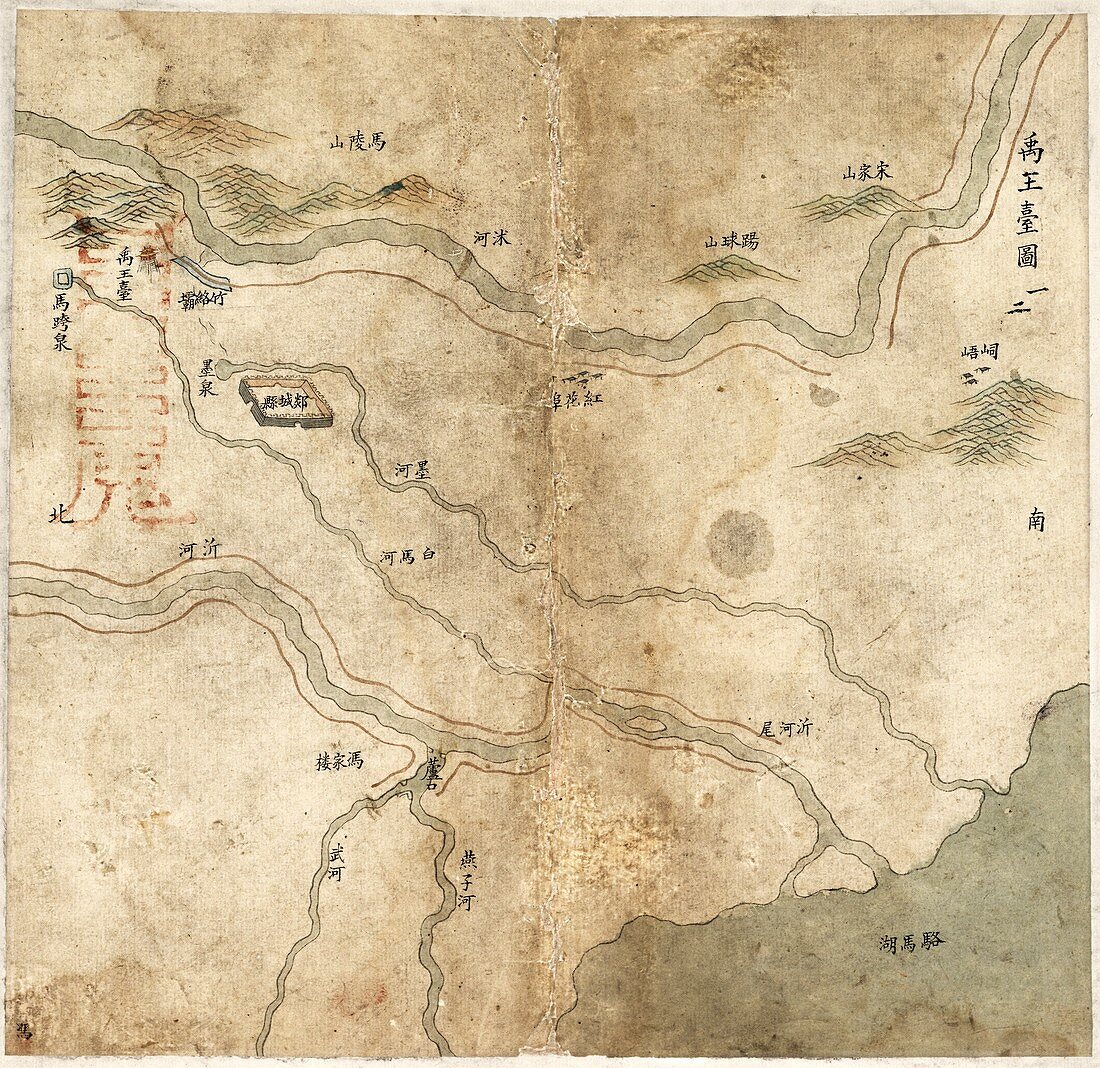
| Chinese river embankments. 18th-century map showing rivers in China,with markings showing where embankments,sluice gates and bridges have been built. North is at bottom,with Luomahu Lake (in Jiangsu province) at lower right. A fortress is also shown at upper left. The area shown is called Yuwangtai (King Yu's Terrace),and is part of a series of maps showing the embankments in an old set of waterways associated with the Yellow River. The embankments are shown by red lines. These defences protect people against floods of the Yellow River which have killed millions. This map dates from some time after 1745 during the Qing Qianlong period | |
| Lizenzart: | Lizenzpflichtig |
| Credit: | Science Photo Library / LIBRARY OF CONGRESS, Geography and Map Division |
| Bildgröße: | 4245 px × 4120 px |
| Modell-Rechte: | nicht erforderlich |
| Eigentums-Rechte: | nicht erforderlich |
| Restrictions: | - |
Preise für dieses Bild ab 15 €
Universitäten & Organisationen
(Informationsmaterial Digital, Informationsmaterial Print, Lehrmaterial Digital etc.)
ab 15 €
Redaktionell
(Bücher, Bücher: Sach- und Fachliteratur, Digitale Medien (redaktionell) etc.)
ab 30 €
Werbung
(Anzeigen, Aussenwerbung, Digitale Medien, Fernsehwerbung, Karten, Werbemittel, Zeitschriften etc.)
ab 55 €
Handelsprodukte
(bedruckte Textilie, Kalender, Postkarte, Grußkarte, Verpackung etc.)
ab 75 €
Pauschalpreise
Rechtepakete für die unbeschränkte Bildnutzung in Print oder Online
ab 495 €
Keywords
- 1700er Jahre,
- 18. Jahrhundert,
- Asiatisch,
- Asien,
- beschriftet,
- Blatt,
- Buch,
- China,
- Chinesisch,
- Deich,
- Einfarbig,
- Etiketten,
- Festung,
- Fluss,
- geografisch,
- Geographie,
- Geschichte,
- historisch,
- Illustration,
- Ingenieurwesen,
- Kanal,
- Karte,
- Kartographie,
- Kunstwerk,
- Niemand,
- Schreiben,
- Schwarz und weiß,
- Skript,
- Text,
- Veröffentlichung,
- Wasserstraßen,
- Wasserweg