Global ocean floor topography
Bildnummer 11724424
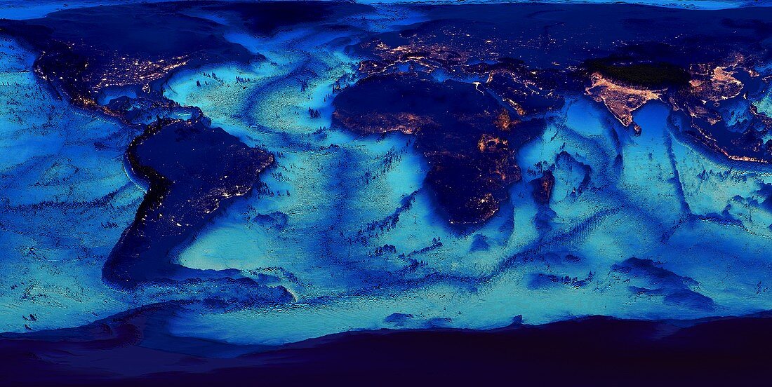
| Global ocean floor topography. Cylindrical projection of the Earth and its oceans,showing the topography of the sea floors. City lights are shown on land. Features highlighted include continental shelves,and oceanic ridges and underwater seamounts and island chains. Bathymetry is the study and mapping of ocean floors. This map was produced from the ETOPO1 dataset. ETOPO1 (2009) was produced by the National Geophysical Data Center of the National Oceanic and Atmospheric Administration (NOAA) | |
| Lizenzart: | Lizenzpflichtig |
| Credit: | Science Photo Library / Pharand-Deschenes, Felix |
| Bildgröße: | 8367 px × 4195 px |
| Modell-Rechte: | nicht erforderlich |
| Eigentums-Rechte: | nicht erforderlich |
| Restrictions: | - |
Preise für dieses Bild ab 15 €
Universitäten & Organisationen
(Informationsmaterial Digital, Informationsmaterial Print, Lehrmaterial Digital etc.)
ab 15 €
Redaktionell
(Bücher, Bücher: Sach- und Fachliteratur, Digitale Medien (redaktionell) etc.)
ab 30 €
Werbung
(Anzeigen, Aussenwerbung, Digitale Medien, Fernsehwerbung, Karten, Werbemittel, Zeitschriften etc.)
ab 55 €
Handelsprodukte
(bedruckte Textilie, Kalender, Postkarte, Grußkarte, Verpackung etc.)
ab 75 €
Pauschalpreise
Rechtepakete für die unbeschränkte Bildnutzung in Print oder Online
ab 495 €