San Francisco Bay area,satellite image
Bildnummer 11720166
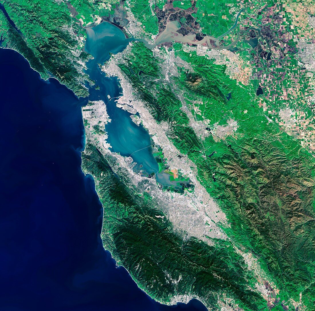
| San Francisco Bay Area. Landsat 8 satellite image of the San Francisco Bay Area,California,USA. North is at top. The city of San Francisco is on a peninsula at centre left. At top centre,the delta of the Sacramento and San Joaquin rivers shows brown,sediment-filled water flowing into the bay. The San Andreas fault runs diagonally southwards from top left. Surrounding San Francisco Bay are urban areas (white/grey),such as Oakland and San Jose. Forests and park areas are shades of green. Agricultural fields are at top right,with the colours depending on the vegetation type. Image obtained by the Landsat 8 satellite on 5 March 2015 | |
| Lizenzart: | Lizenzpflichtig |
| Credit: | Science Photo Library / ESA / US Geological Survey |
| Bildgröße: | 4873 px × 4814 px |
| Modell-Rechte: | nicht erforderlich |
| Eigentums-Rechte: | nicht erforderlich |
| Restrictions: |
|
Preise für dieses Bild ab 15 €
Universitäten & Organisationen
(Informationsmaterial Digital, Informationsmaterial Print, Lehrmaterial Digital etc.)
ab 15 €
Redaktionell
(Bücher, Bücher: Sach- und Fachliteratur, Digitale Medien (redaktionell) etc.)
ab 30 €
Werbung
(Anzeigen, Aussenwerbung, Digitale Medien, Fernsehwerbung, Karten, Werbemittel, Zeitschriften etc.)
ab 55 €
Handelsprodukte
(bedruckte Textilie, Kalender, Postkarte, Grußkarte, Verpackung etc.)
ab 75 €
Pauschalpreise
Rechtepakete für die unbeschränkte Bildnutzung in Print oder Online
ab 495 €
Keywords
- 2015,
- 21. Jahrhundert,
- Amerikanisch,
- Bauernhöfe,
- Berge,
- Bucht,
- Bucht von San Francisco,
- Delta,
- Erdbeobachtung,
- Felder,
- Fluss,
- Flüsse,
- geografisch,
- Geographie,
- Halbinsel,
- Kalifornien,
- Kalifornisch,
- Küste,
- Küsten-,
- Land,
- Landsat 8,
- Meer,
- menschliche Geografie,
- Niemand,
- Nordamerika,
- nordamerikanisch,
- optisch,
- Ozean,
- San Francisco,
- San Joaquin,
- San Jose,
- Satellit,
- Satellitenbild,
- Sichtbar,
- Stadt,
- uns,
- USA,
- Vereinigte Staaten,
- Wälder,
- Wasser,
- Weltall