ADM-Aeolus satellite,illustration
Bildnummer 11720163
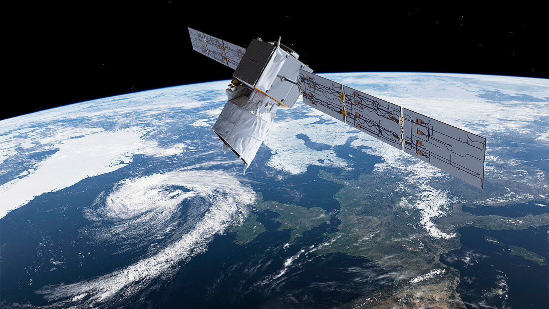
| ADM-Aeolus satellite and cyclone. Illustration of the European Space Agency (ESA) wind mission satellite ADM-Aeolus (Atmospheric Dynamics Mission Aeolus),in Earth orbit. At lower left is a cyclonic storm system moving over the UK. This satellite,due for launch in 2017,is intended to provide data on winds,aerosols (atmospheric particles) and clouds. It will have a single instrument,a Doppler wind lidar (laser-based sensor) called ALADIN. It will probe the lowermost 30 kilometres of the atmosphere,and will will be the first wind lidar in space. Data will be used to help improve weather forecasts,such as the prediction of mid-latitude cyclone systems | |
| Lizenzart: | Lizenzpflichtig |
| Credit: | Science Photo Library / ESA / ATG Medialab |
| Bildgröße: | 5002 px × 2815 px |
| Modell-Rechte: | nicht erforderlich |
| Eigentums-Rechte: | nicht erforderlich |
| Restrictions: |
|
Preise für dieses Bild ab 15 €
Universitäten & Organisationen
(Informationsmaterial Digital, Informationsmaterial Print, Lehrmaterial Digital etc.)
ab 15 €
Redaktionell
(Bücher, Bücher: Sach- und Fachliteratur, Digitale Medien (redaktionell) etc.)
ab 30 €
Werbung
(Anzeigen, Aussenwerbung, Digitale Medien, Fernsehwerbung, Karten, Werbemittel, Zeitschriften etc.)
ab 55 €
Handelsprodukte
(bedruckte Textilie, Kalender, Postkarte, Grußkarte, Verpackung etc.)
ab 75 €
Pauschalpreise
Rechtepakete für die unbeschränkte Bildnutzung in Print oder Online
ab 495 €
Keywords
- 2018,
- 21. Jahrhundert,
- Äolus,
- britisch,
- Erdbeobachtung,
- Erde,
- Europa,
- europäisch,
- Großbritannien,
- Illustration,
- Ingenieurwesen,
- Kunstwerk,
- Laser,
- Messung,
- Meteorologie,
- meteorologisch,
- Niemand,
- Planet,
- Raum,
- Satellit,
- Sturm,
- Technologie,
- technologisch,
- Überwachung,
- umkreisend,
- Vereinigtes Königreich,
- Weltraumflug,
- Wetter