Luzon island,satellite image
Bildnummer 11716854
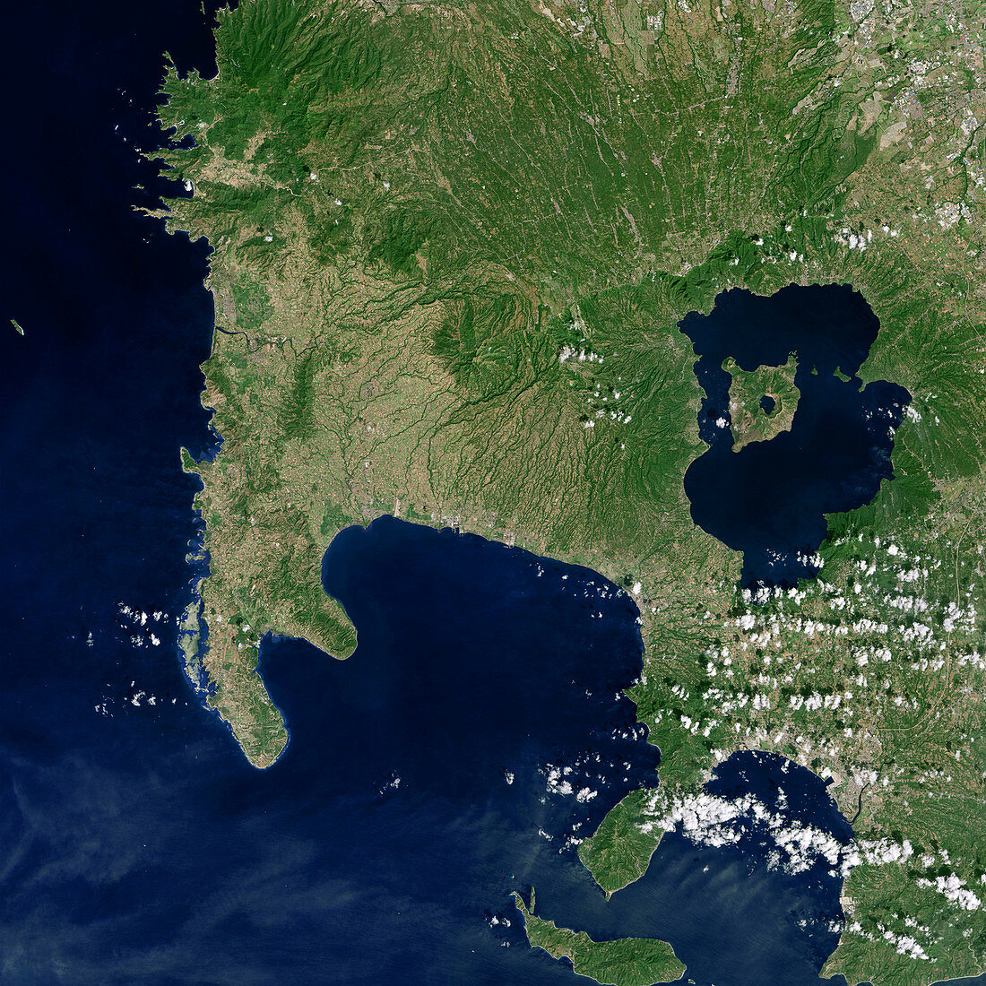
| Luzon island. Satellite image of the southwestern tip of Luzon island in the Philippines,showing Volcano Island lying in Taal Lake (blue,right). Volcano Island is the centre of activity from the Taal Volcano,with Taal Lake partially filling the volcano's caldera. Tall Volcano is the second most active volcano in the Philippines and consists of multiple stratovolcanos,conical hills and craters of all shapes and sizes that have grown together to form the 5-kilometre-wide Volcano Island. All recorded eruptions of Tall have stemmed from Volcano Island. Imaged by the Operational Land Imager (OLI) onboard the Landsat 8 satellite,on 7th February 2014 | |
| Lizenzart: | Lizenzpflichtig |
| Credit: | Science Photo Library / NASA |
| Bildgröße: | 2956 px × 2956 px |
| Modell-Rechte: | nicht erforderlich |
| Eigentums-Rechte: | nicht erforderlich |
| Restrictions: | - |
Preise für dieses Bild ab 15 €
Universitäten & Organisationen
(Informationsmaterial Digital, Informationsmaterial Print, Lehrmaterial Digital etc.)
ab 15 €
Redaktionell
(Bücher, Bücher: Sach- und Fachliteratur, Digitale Medien (redaktionell) etc.)
ab 30 €
Werbung
(Anzeigen, Aussenwerbung, Digitale Medien, Fernsehwerbung, Karten, Werbemittel, Zeitschriften etc.)
ab 55 €
Handelsprodukte
(bedruckte Textilie, Kalender, Postkarte, Grußkarte, Verpackung etc.)
ab 75 €
Pauschalpreise
Rechtepakete für die unbeschränkte Bildnutzung in Print oder Online
ab 495 €