Marine geologist studying seafloor map
Bildnummer 11713160
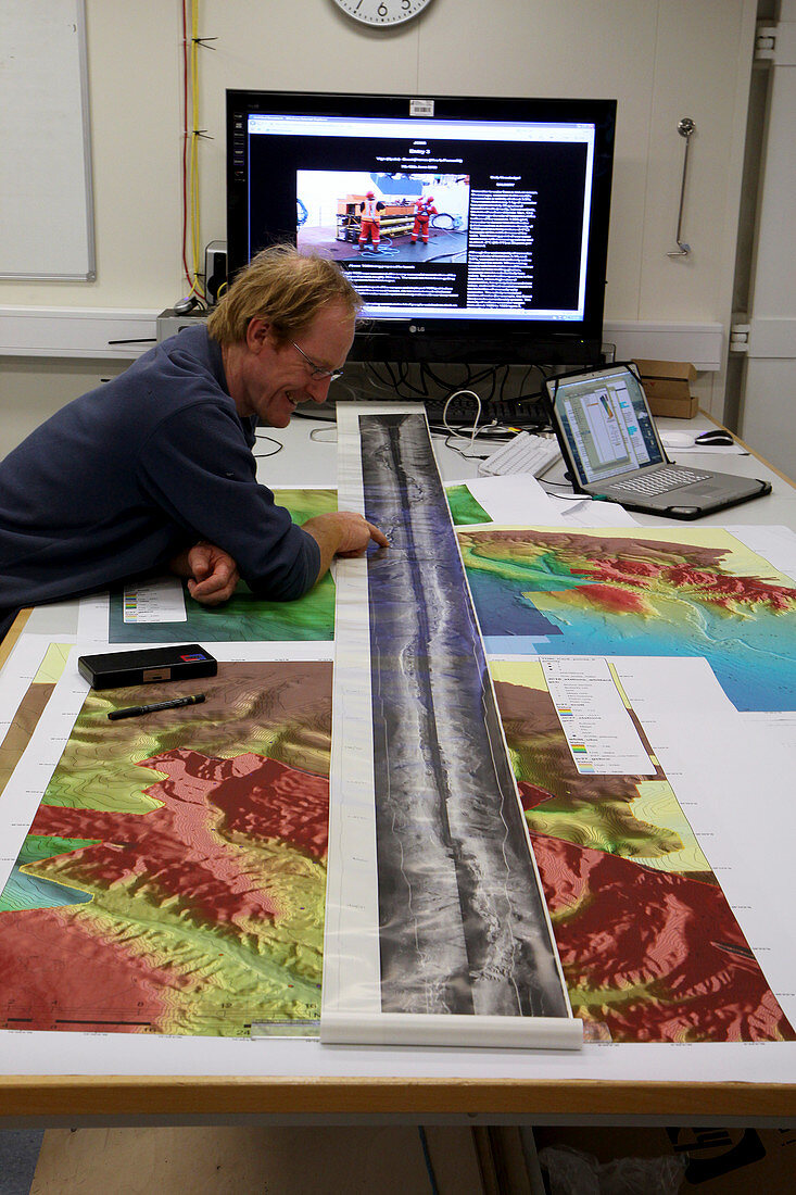
| MODEL RELEASED. Marine geologist studying a seafloor map produced by the TOBI (Towed Ocean Bottom Instrument) seafloor mapping instrument. TOBI is a sidescan sonar unit that is towed behind a ship. It sends pulsed sound waves towards the seafloor and records the echo-like reflections to create an image of the seafloor. Photographed on board RRS James Cook in the Caribbean,in 2010 | |
| Lizenzart: | Lizenzpflichtig |
| Credit: | Science Photo Library / Murton, B. / Southampton Oceanography Centre |
| Bildgröße: | 3417 px × 5126 px |
| Modell-Rechte: | vorhanden |
| Eigentums-Rechte: | nicht erforderlich |
| Restrictions: | - |
Preise für dieses Bild ab 15 €
Universitäten & Organisationen
(Informationsmaterial Digital, Informationsmaterial Print, Lehrmaterial Digital etc.)
ab 15 €
Redaktionell
(Bücher, Bücher: Sach- und Fachliteratur, Digitale Medien (redaktionell) etc.)
ab 30 €
Werbung
(Anzeigen, Aussenwerbung, Digitale Medien, Fernsehwerbung, Karten, Werbemittel, Zeitschriften etc.)
ab 55 €
Handelsprodukte
(bedruckte Textilie, Kalender, Postkarte, Grußkarte, Verpackung etc.)
ab 75 €
Pauschalpreise
Rechtepakete für die unbeschränkte Bildnutzung in Print oder Online
ab 495 €