Map of Bombay coastline,17th century
Bildnummer 11703529
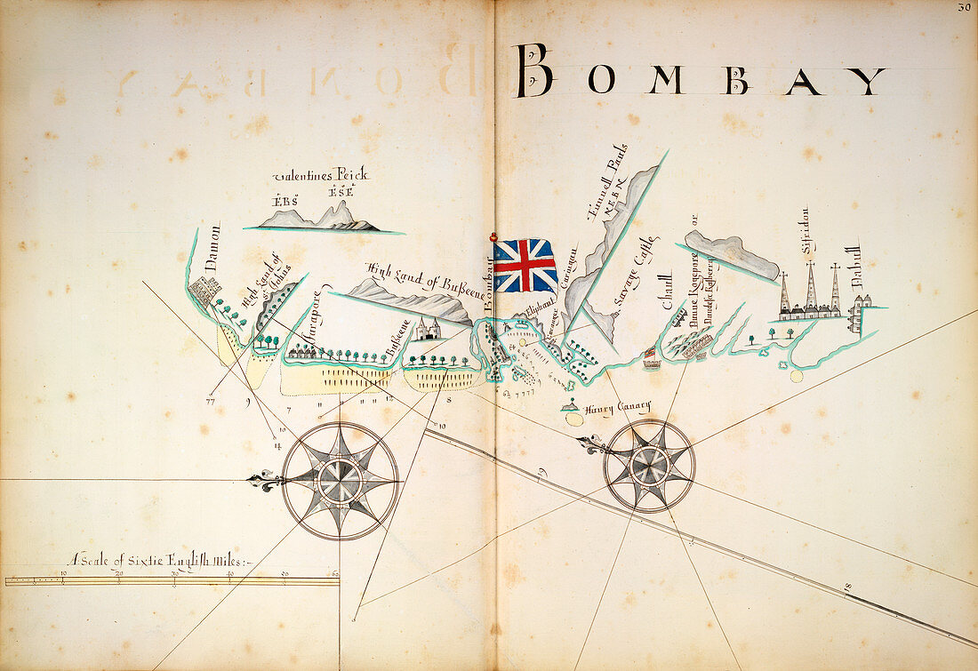
| Map of Bombay coastline. 17th-century map of the coastline around the Indian city of Bombay (now known as Mumbai). This map was drawn in around 1680 by English cartographer William Hacke (fl. 1680-1710). The scale at lower left is for a distance of 60 English miles. At upper left are views of Valentine's Peak. Other places named include the fort of 'Savage Castle',and the 'high land of Basseene'. At centre,the flag of Great Britain flies over the main bay. Bombay was placed under British rule in 1661,then transferred to the East India Company in 1668. Direct colonial rule of Bombay by the British Crown dates from the 1850s | |
| Lizenzart: | Lizenzpflichtig |
| Credit: | Science Photo Library / British Library |
| Bildgröße: | 5072 px × 3482 px |
| Modell-Rechte: | nicht erforderlich |
| Eigentums-Rechte: | nicht erforderlich |
| Restrictions: | - |
Preise für dieses Bild ab 15 €
Universitäten & Organisationen
(Informationsmaterial Digital, Informationsmaterial Print, Lehrmaterial Digital etc.)
ab 15 €
Redaktionell
(Bücher, Bücher: Sach- und Fachliteratur, Digitale Medien (redaktionell) etc.)
ab 30 €
Werbung
(Anzeigen, Aussenwerbung, Digitale Medien, Fernsehwerbung, Karten, Werbemittel, Zeitschriften etc.)
ab 55 €
Handelsprodukte
(bedruckte Textilie, Kalender, Postkarte, Grußkarte, Verpackung etc.)
ab 75 €
Pauschalpreise
Rechtepakete für die unbeschränkte Bildnutzung in Print oder Online
ab 495 €
Keywords
- 1600er Jahre,
- 17. Jahrhundert,
- Asiatisch,
- Asien,
- Berge,
- Bombay,
- Bucht,
- Diagramm,
- Englisch,
- Flagge,
- Flüsse,
- geografisch,
- Geographie,
- Geschichte,
- Handel,
- historisch,
- Hügel,
- Illustration,
- Indien,
- Indisch,
- Karte,
- Kartographie,
- Kirche,
- Kirchen,
- Kolonie,
- Kunstwerk,
- Küste,
- Küsten-,
- Küstenlinie,
- Maßstab,
- Mumbai,
- Niemand,
- Schloss,
- Schlösser,
- Stadt,
- Topographie