Mont Saint-Michel bay,satellite image
Bildnummer 11700242
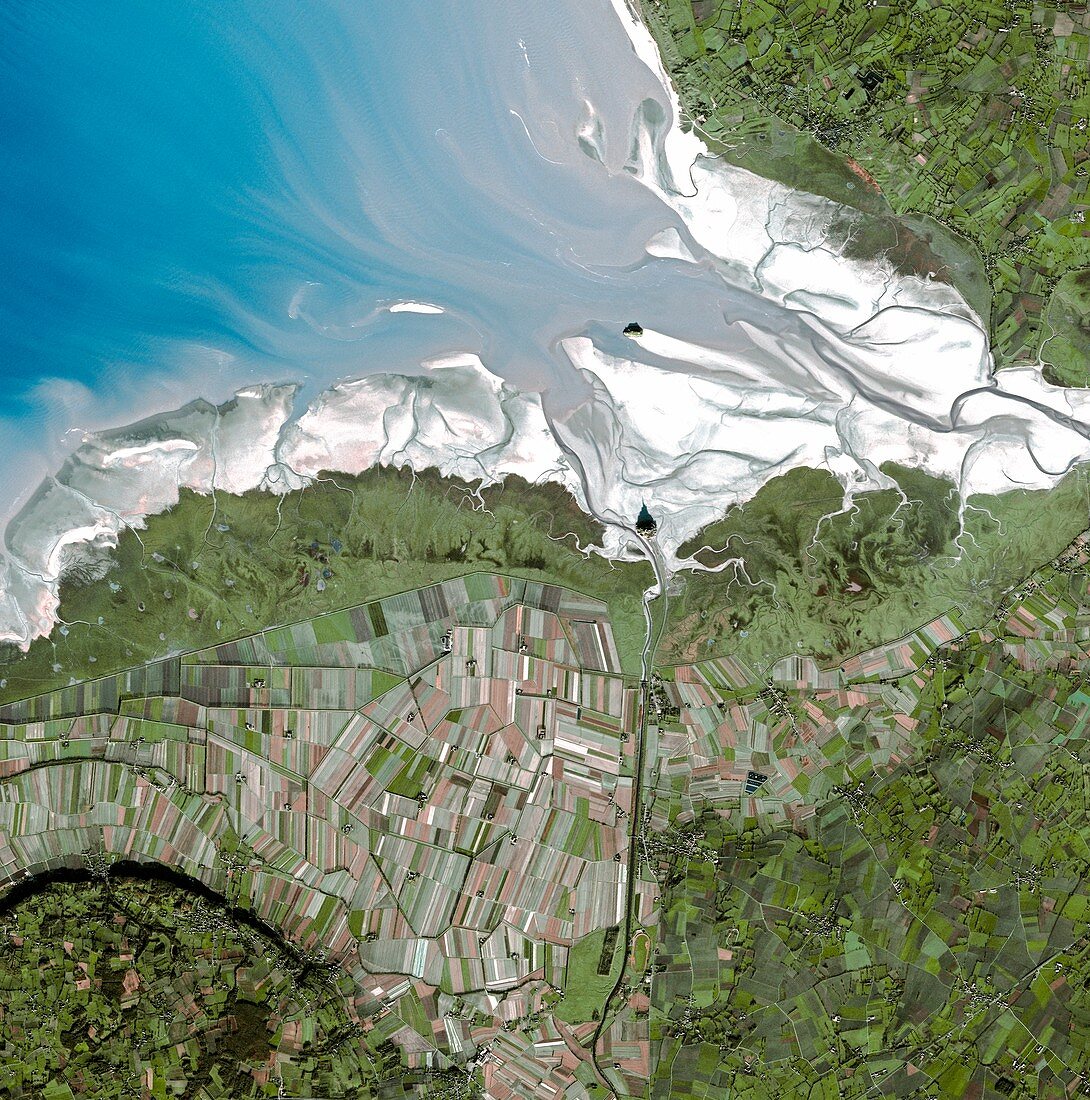
| Mont Saint-Michel bay,satellite image. North is at top. The island of Mont Saint-Michel is at centre,at the mouth of the Couesnon River (running from the south) on the Atlantic coast of Normandy,France. Shadows are cast northwards. The rivers See and Selune flow from right. Mont Saint-Michel,a UNESCO World Heritage Site,used to be a tidal island,but since the late 1800s has been accessible by a raised causeway from the mainland. It is surrounded by extensive mudflats at low tide. The island in the estuary at upper centre is Tombelaine. Fields dominate the surrounding land. This image was obtained by the SPOT 5 satellite on 17 December 2003 | |
| Lizenzart: | Lizenzpflichtig |
| Credit: | Science Photo Library / Infoterra |
| Bildgröße: | 4179 px × 4217 px |
| Modell-Rechte: | nicht erforderlich |
| Eigentums-Rechte: | nicht erforderlich |
| Restrictions: | - |
Preise für dieses Bild ab 15 €
Universitäten & Organisationen
(Informationsmaterial Digital, Informationsmaterial Print, Lehrmaterial Digital etc.)
ab 15 €
Redaktionell
(Bücher, Bücher: Sach- und Fachliteratur, Digitale Medien (redaktionell) etc.)
ab 30 €
Werbung
(Anzeigen, Aussenwerbung, Digitale Medien, Fernsehwerbung, Karten, Werbemittel, Zeitschriften etc.)
ab 55 €
Handelsprodukte
(bedruckte Textilie, Kalender, Postkarte, Grußkarte, Verpackung etc.)
ab 75 €
Pauschalpreise
Rechtepakete für die unbeschränkte Bildnutzung in Print oder Online
ab 495 €
Keywords
- 21. Jahrhundert,
- Abtei,
- Bucht,
- Erdbeobachtung,
- Europa,
- europäisch,
- Feld,
- Felder,
- Flut-,
- Frankreich,
- Französisch,
- geografisch,
- Geographie,
- Insel,
- Küste,
- Küstenlinie,
- Landwirtschaft,
- landwirtschaftlich,
- Mündung,
- Niemand,
- Normandie,
- optisch,
- Satellit,
- Satellitenbild,
- Schatten,
- Sehen,
- Sichtbar,
- UNESCO-Weltkulturerbe,
- Wattenmeer,
- Weltall