Hawaii,satellite image
Bildnummer 11698979
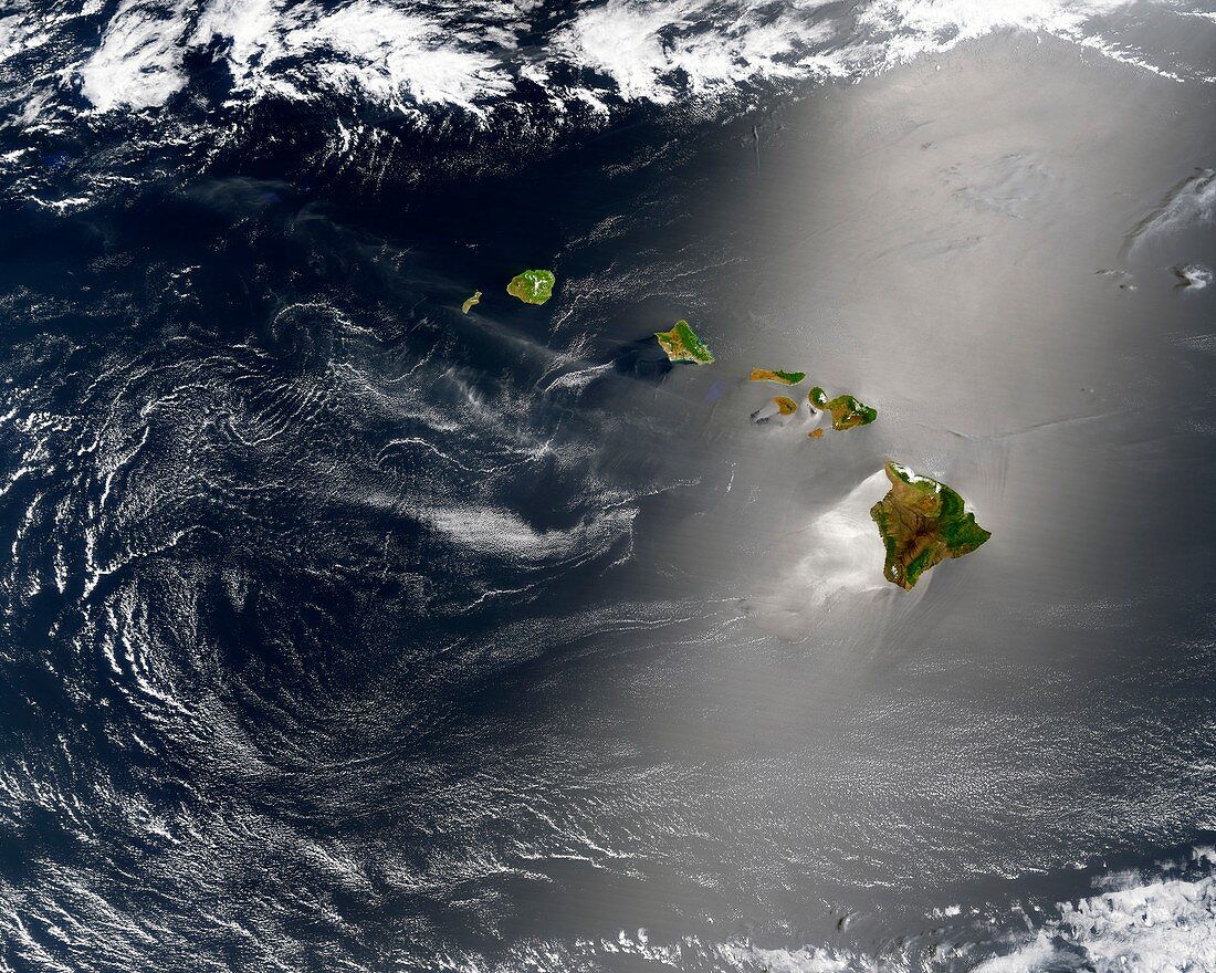
| Hawaii. Satellite image of the Hawaiian Islands,with glinting sunlight showing turbulence in the surface waters of the Pacific Ocean. The Hawaiian Islands are an archipelago in the North Pacific Ocean that extend around 2400 km from the island of Hawaii (Big Island) in the south,to the northernmost Kure Atoll. Imaged by the Moderate Resolution Imaging Spectroradiometer (MODIS) on NASA's Terra satellite,on 27th May 2003 | |
| Lizenzart: | Lizenzpflichtig |
| Credit: | Science Photo Library / GSFC / Jacques Descloitres, MODIS Land Rapid Response Team at NASA |
| Bildgröße: | 4902 px × 3921 px |
| Modell-Rechte: | nicht erforderlich |
| Eigentums-Rechte: | nicht erforderlich |
| Restrictions: | - |
Preise für dieses Bild ab 15 €
Universitäten & Organisationen
(Informationsmaterial Digital, Informationsmaterial Print, Lehrmaterial Digital etc.)
ab 15 €
Redaktionell
(Bücher, Bücher: Sach- und Fachliteratur, Digitale Medien (redaktionell) etc.)
ab 30 €
Werbung
(Anzeigen, Aussenwerbung, Digitale Medien, Fernsehwerbung, Karten, Werbemittel, Zeitschriften etc.)
ab 55 €
Handelsprodukte
(bedruckte Textilie, Kalender, Postkarte, Grußkarte, Verpackung etc.)
ab 75 €
Pauschalpreise
Rechtepakete für die unbeschränkte Bildnutzung in Print oder Online
ab 495 €
Keywords
- 21. Jahrhundert,
- Amerikanisch,
- Archipel,
- geografisch,
- Geographie,
- Geologie,
- geologisch,
- Hawaii,
- Insel,
- Luftaufnahme,
- Meteorologie,
- meteorologisch,
- modis,
- NASA,
- Niemand,
- Pazifik,
- Satellitenbild,
- Sonnenlicht,
- Terra satellit,
- Umwelt,
- Umweltwissenschaften,
- uns,
- USA,
- Vereinigte Staaten,
- Von Oben,
- vulkanisch,
- Vulkanologie,
- Wasser,
- Wetter,
- Wolke,
- Wolken