Danube Delta,satellite image
Bildnummer 11698970
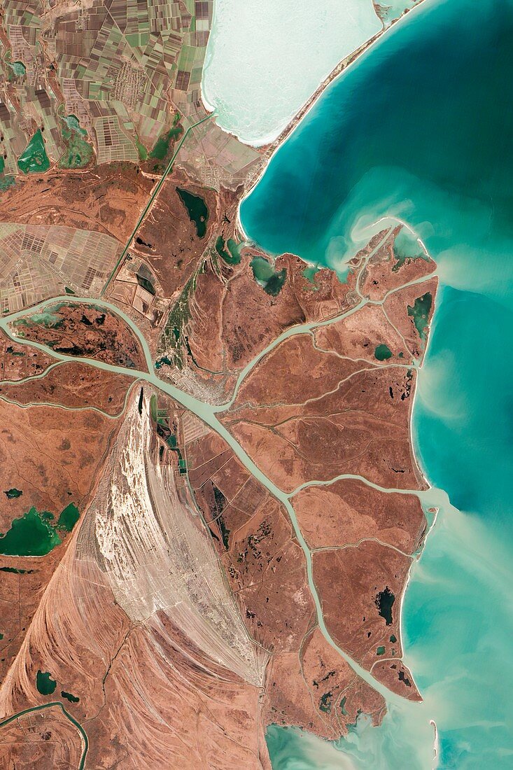
| Danube Delta. Satellite image focused on the northernmost Chilia (or Kilia) lobe of the Danube Delta,the second largest river delta in Europe. This delta is made up of a number of lobes and drains over 800,000 square kilometres of land across 19 countries. Where the river reaches the Black Sea (upper right),another remarkable delta has formed an area dubbed the 'Everglades of Europe'. Imaged by the Advanced Land Imager (ALI) on NASA's Earth Observing-1 (EO-1) satellite,on 5th February 2013 | |
| Lizenzart: | Lizenzpflichtig |
| Credit: | Science Photo Library / US Geological Survery / EO-1 team / Jesse Allen and Robert Simmon / NASA Earth Observatory |
| Bildgröße: | 3413 px × 5119 px |
| Modell-Rechte: | nicht erforderlich |
| Eigentums-Rechte: | nicht erforderlich |
| Restrictions: | - |
Preise für dieses Bild ab 15 €
Universitäten & Organisationen
(Informationsmaterial Digital, Informationsmaterial Print, Lehrmaterial Digital etc.)
ab 15 €
Redaktionell
(Bücher, Bücher: Sach- und Fachliteratur, Digitale Medien (redaktionell) etc.)
ab 30 €
Werbung
(Anzeigen, Aussenwerbung, Digitale Medien, Fernsehwerbung, Karten, Werbemittel, Zeitschriften etc.)
ab 55 €
Handelsprodukte
(bedruckte Textilie, Kalender, Postkarte, Grußkarte, Verpackung etc.)
ab 75 €
Pauschalpreise
Rechtepakete für die unbeschränkte Bildnutzung in Print oder Online
ab 495 €